East Anglia,natural colour mosaic
Bildnummer 11736193
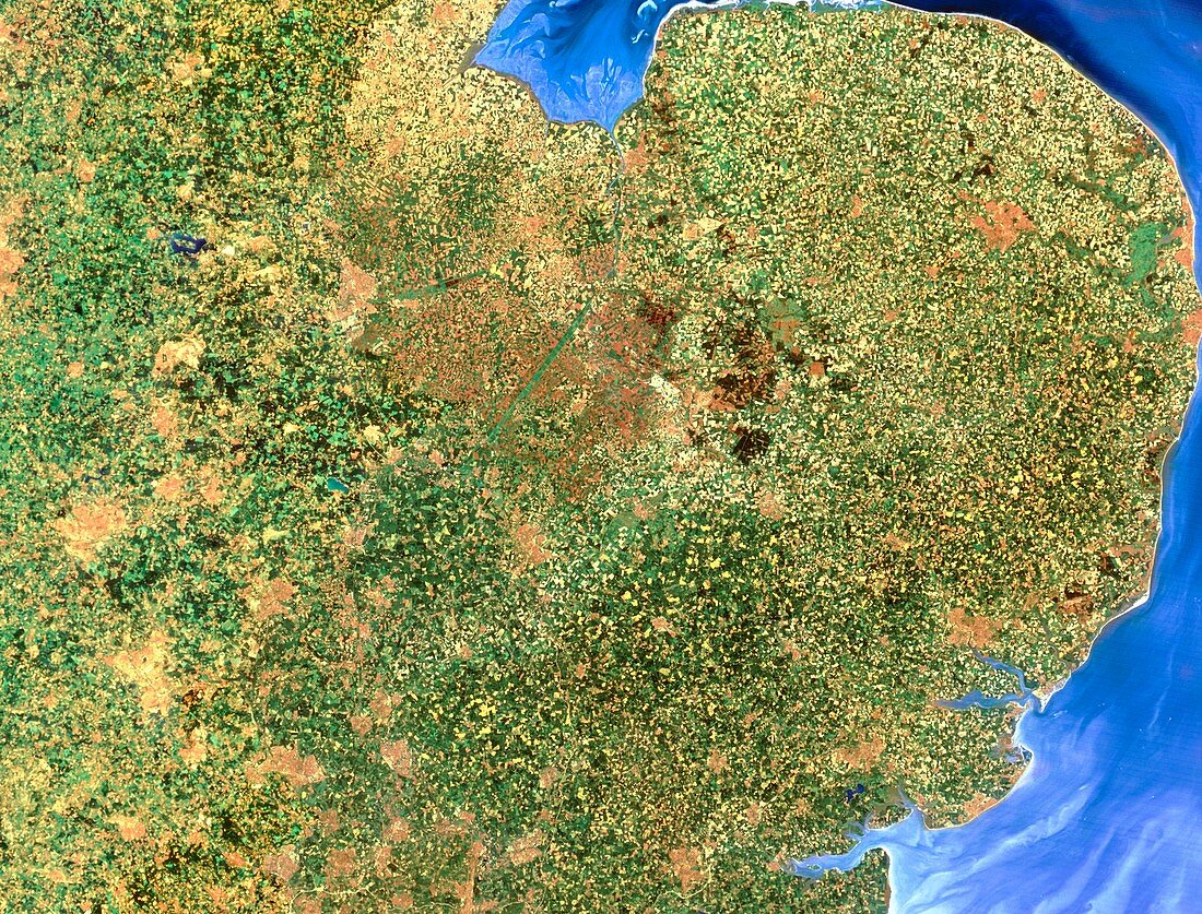
| East Anglia,from space. Mosaic of satellite images showing East Anglia,England. The colours approximate to natural tones. East Anglia is a predominantly low-relief agricultural area,as seen by the many green tones. Urban areas are pale brown. Much of the area around The Wash (the square bay at top centre) is below mean sea level,and has an extensive drainage system to support local horticulture. On the east (right) coast is a large,drab green area; this is the Norfolk Broads,a famous inland waterway network. Note also the heavy sedimentation off shore (pale blue-grey). The data for this image were gathered by Landsat satellites | |
| Lizenzart: | Lizenzpflichtig |
| Credit: | Science Photo Library / MAP APPEAL / NRSC LTD |
| Bildgröße: | 4843 px × 3686 px |
| Modell-Rechte: | nicht erforderlich |
| Eigentums-Rechte: | nicht erforderlich |
| Restrictions: | - |
Preise für dieses Bild ab 15 €
Universitäten & Organisationen
(Informationsmaterial Digital, Informationsmaterial Print, Lehrmaterial Digital etc.)
ab 15 €
Redaktionell
(Bücher, Bücher: Sach- und Fachliteratur, Digitale Medien (redaktionell) etc.)
ab 30 €
Werbung
(Anzeigen, Aussenwerbung, Digitale Medien, Fernsehwerbung, Karten, Werbemittel, Zeitschriften etc.)
ab 55 €
Handelsprodukte
(bedruckte Textilie, Kalender, Postkarte, Grußkarte, Verpackung etc.)
ab 75 €
Pauschalpreise
Rechtepakete für die unbeschränkte Bildnutzung in Print oder Online
ab 495 €