Satellite view of Liverpool/Manchester region
Bildnummer 11736188
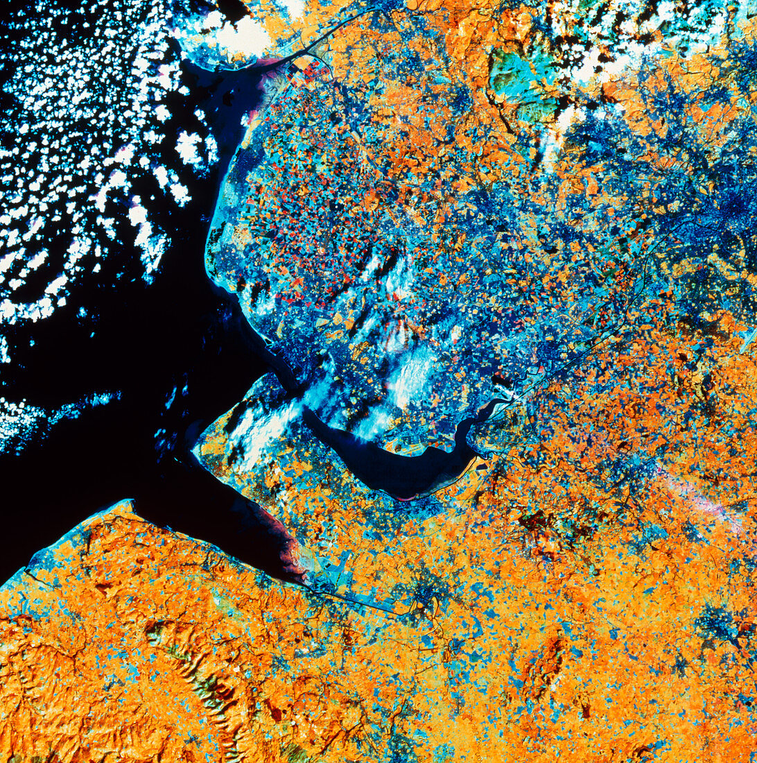
| North-west England. Satellite view of part of the north-west of England. The colours in the image indicate the surface cover: cities are shown in dark blue and open grassland as yellow. At the centre of the frame is Liverpool and the Mersey estuary. At top right is Manchester. Between the head of the Mersey estuary (near the smoke plume at centre) and Manchester is Warrington. The rectangular peninsula is called the Wirral,the estuary to the left of this is the outlet of the River Dee. The land in the bottom left is in the Welsh county of Clwyd. The data for this image were gathered by the Landsat 5 satellite | |
| Lizenzart: | Lizenzpflichtig |
| Credit: | Science Photo Library / NRSC LTD |
| Bildgröße: | 4454 px × 4488 px |
| Modell-Rechte: | nicht erforderlich |
| Eigentums-Rechte: | nicht erforderlich |
| Restrictions: | - |
Preise für dieses Bild ab 15 €
Universitäten & Organisationen
(Informationsmaterial Digital, Informationsmaterial Print, Lehrmaterial Digital etc.)
ab 15 €
Redaktionell
(Bücher, Bücher: Sach- und Fachliteratur, Digitale Medien (redaktionell) etc.)
ab 30 €
Werbung
(Anzeigen, Aussenwerbung, Digitale Medien, Fernsehwerbung, Karten, Werbemittel, Zeitschriften etc.)
ab 55 €
Handelsprodukte
(bedruckte Textilie, Kalender, Postkarte, Grußkarte, Verpackung etc.)
ab 75 €
Pauschalpreise
Rechtepakete für die unbeschränkte Bildnutzung in Print oder Online
ab 495 €