Landsat mosaic of The West Country
Bildnummer 11736173
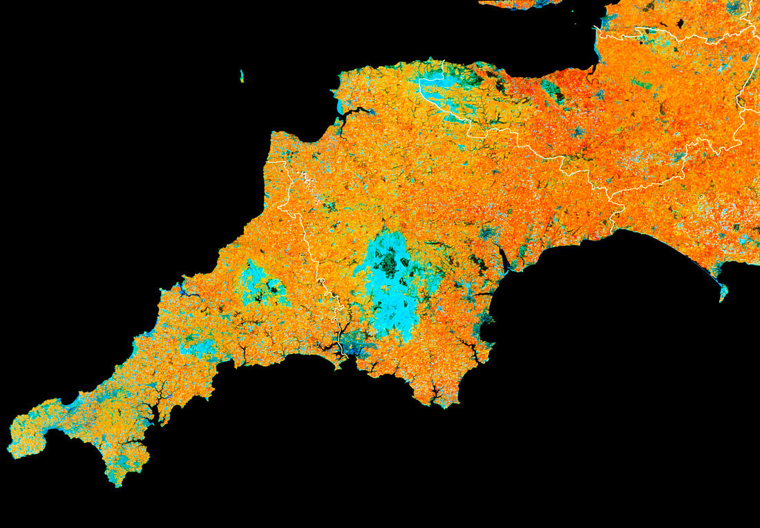
| The West Country seen from space. False-colour mosaic of Landsat images of south-west England,known as the 'West Country'. The whole of this region is dominated by agricultural land,mainly rich pasture (reddish brown) and rougher grassland (paler brown). Four large moorland areas are seen as pale blue: at centre is Dartmoor,above this is Exmoor and to the left are the Bodmin Moors. White lines delineate county boundaries. The counties are (left to right): Cornwall,Devon and Somerset. Part of Dorset is seen at centre right. Note also the convoluted shapes of river estuaries on the south coast. The farthest point to the left is Land's End | |
| Lizenzart: | Lizenzpflichtig |
| Credit: | Science Photo Library / NRSC LTD |
| Bildgröße: | 3567 px × 2480 px |
| Modell-Rechte: | nicht erforderlich |
| Eigentums-Rechte: | nicht erforderlich |
| Restrictions: | - |
Preise für dieses Bild ab 15 €
Universitäten & Organisationen
(Informationsmaterial Digital, Informationsmaterial Print, Lehrmaterial Digital etc.)
ab 15 €
Redaktionell
(Bücher, Bücher: Sach- und Fachliteratur, Digitale Medien (redaktionell) etc.)
ab 30 €
Werbung
(Anzeigen, Aussenwerbung, Digitale Medien, Fernsehwerbung, Karten, Werbemittel, Zeitschriften etc.)
ab 55 €
Handelsprodukte
(bedruckte Textilie, Kalender, Postkarte, Grußkarte, Verpackung etc.)
ab 75 €
Pauschalpreise
Rechtepakete für die unbeschränkte Bildnutzung in Print oder Online
ab 495 €