Belgium,satellite image
Bildnummer 11736126
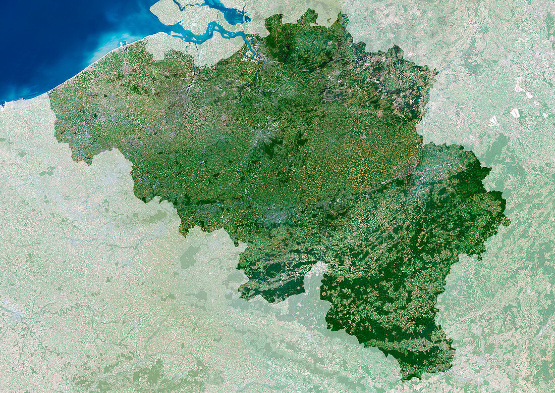
| Belgium,satellite image. North is at top. Grey areas are urban areas,vegetated areas are green. Belgium is bordered by the Netherlands in the north,Germany and Luxembourg in the east and France in the southwest. Brussels is its capital city. It houses the headquarters of the European Union (EU) and the North Atlantic Treaty Organisation (NATO). Brussels is seen as the grey urban area at centre. The large river estuary at the top of the image is the Westerschelde | |
| Lizenzart: | Lizenzpflichtig |
| Credit: | Science Photo Library / Planetobserver |
| Bildgröße: | 4961 px × 3508 px |
| Modell-Rechte: | nicht erforderlich |
| Eigentums-Rechte: | nicht erforderlich |
| Restrictions: | - |
Preise für dieses Bild ab 15 €
Universitäten & Organisationen
(Informationsmaterial Digital, Informationsmaterial Print, Lehrmaterial Digital etc.)
ab 15 €
Redaktionell
(Bücher, Bücher: Sach- und Fachliteratur, Digitale Medien (redaktionell) etc.)
ab 30 €
Werbung
(Anzeigen, Aussenwerbung, Digitale Medien, Fernsehwerbung, Karten, Werbemittel, Zeitschriften etc.)
ab 55 €
Handelsprodukte
(bedruckte Textilie, Kalender, Postkarte, Grußkarte, Verpackung etc.)
ab 75 €
Pauschalpreise
Rechtepakete für die unbeschränkte Bildnutzung in Print oder Online
ab 495 €