USA,satellite image
Bildnummer 11736122
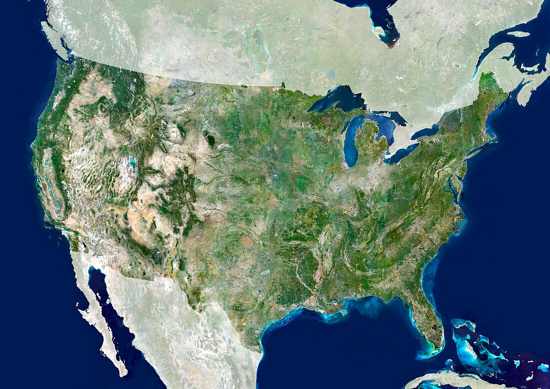
| USA,satellite image. North is at top. The USA consists of the lower 48 states (shown). The Pacific islands of Hawaii and Alaska,which is separated from the lower 48 states by Canada,make up the other two states (not shown). The USA borders Canada to the north and Mexico to the south. The Gulf of Mexico forms the southeast coast of the USA. The Pacific west coast of the USA is dominated by the Rocky Mountains. The Great Lakes in the northwest are the largest group of freshwater lakes on Earth. The USA's Capital city,Washington and largest city,New York are located on the Atlantic coast | |
| Lizenzart: | Lizenzpflichtig |
| Credit: | Science Photo Library / Planetobserver |
| Bildgröße: | 4961 px × 3508 px |
| Modell-Rechte: | nicht erforderlich |
| Eigentums-Rechte: | nicht erforderlich |
| Restrictions: | - |
Preise für dieses Bild ab 15 €
Universitäten & Organisationen
(Informationsmaterial Digital, Informationsmaterial Print, Lehrmaterial Digital etc.)
ab 15 €
Redaktionell
(Bücher, Bücher: Sach- und Fachliteratur, Digitale Medien (redaktionell) etc.)
ab 30 €
Werbung
(Anzeigen, Aussenwerbung, Digitale Medien, Fernsehwerbung, Karten, Werbemittel, Zeitschriften etc.)
ab 55 €
Handelsprodukte
(bedruckte Textilie, Kalender, Postkarte, Grußkarte, Verpackung etc.)
ab 75 €
Pauschalpreise
Rechtepakete für die unbeschränkte Bildnutzung in Print oder Online
ab 495 €
Keywords
- Amerikanisch,
- Atlantischer Ozean,
- Berge,
- Erdbeobachtung,
- Erde,
- Erdkunde,
- geografisch,
- Geographie,
- Great Plains,
- Große Seen,
- Kanada,
- Karibik,
- Land,
- Länder,
- Meer,
- Mexiko,
- Nation,
- Nationen,
- Nordamerika,
- nordamerikanisch,
- Ozean,
- Pazifik,
- Rocky Mountains,
- Satellitenbild,
- Seen,
- Topographie,
- uns,
- USA,
- Vereinigte Staaten,
- Weltall,
- Wissenschaften