USA
Bildnummer 11736056
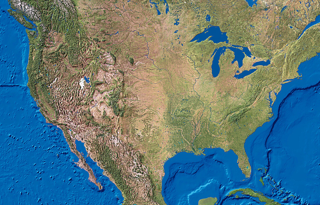
| USA. True-colour satellite image of the United States of America and the surrounding regions. North is at top. Vegetation is green,arid areas are brown and water is blue. The topography of the Pacific (left) and Atlantic (right) Oceans is shown. The peninsula of Florida (lower right) lies to the right of the Gulf of Mexico. The USA is bounded by Canada (top) to the north,and Mexico (bottom) to the south. The Great Lakes of Canada and the USA are at upper right. Snow-capped mountains range down the western regions (left) | |
| Lizenzart: | Lizenzpflichtig |
| Credit: | Science Photo Library / Worldsat International |
| Bildgröße: | 4000 px × 2561 px |
| Modell-Rechte: | nicht erforderlich |
| Eigentums-Rechte: | nicht erforderlich |
| Restrictions: |
|
Preise für dieses Bild ab 15 €
Universitäten & Organisationen
(Informationsmaterial Digital, Informationsmaterial Print, Lehrmaterial Digital etc.)
ab 15 €
Redaktionell
(Bücher, Bücher: Sach- und Fachliteratur, Digitale Medien (redaktionell) etc.)
ab 30 €
Werbung
(Anzeigen, Aussenwerbung, Digitale Medien, Fernsehwerbung, Karten, Werbemittel, Zeitschriften etc.)
ab 55 €
Handelsprodukte
(bedruckte Textilie, Kalender, Postkarte, Grußkarte, Verpackung etc.)
ab 75 €
Pauschalpreise
Rechtepakete für die unbeschränkte Bildnutzung in Print oder Online
ab 495 €