North Atlantic Ridge,topographical map
Bildnummer 11735952
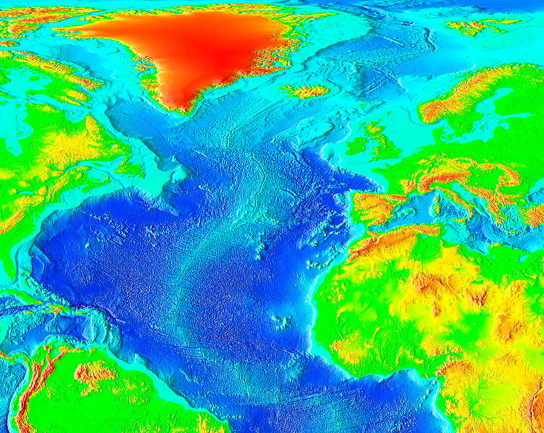
| North Atlantic Ridge,topographical map. Elevation is colour-coded. On land,low-lying areas are green,with yellow,orange and red indicating higher elevations. In the oceans,the shallow waters of the continental shelf are turquoise,with deeper blues showing deeper water. The North Atlantic Ridge is the northern part of the mid- Atlantic Ridge,a long submarine mountain range that runs from nearly the North Pole to the South Atlantic Ocean. It is formed by the upwelling of magma as the continents drift apart,which causes the Atlantic Ocean to grow by 5-10 centimetres annually. The ridge passes through the island of Iceland (upper centre) | |
| Lizenzart: | Lizenzpflichtig |
| Credit: | Science Photo Library / NOAA |
| Bildgröße: | 3456 px × 2752 px |
| Modell-Rechte: | nicht erforderlich |
| Eigentums-Rechte: | nicht erforderlich |
| Restrictions: |
|
Preise für dieses Bild ab 15 €
Universitäten & Organisationen
(Informationsmaterial Digital, Informationsmaterial Print, Lehrmaterial Digital etc.)
ab 15 €
Redaktionell
(Bücher, Bücher: Sach- und Fachliteratur, Digitale Medien (redaktionell) etc.)
ab 30 €
Werbung
(Anzeigen, Aussenwerbung, Digitale Medien, Fernsehwerbung, Karten, Werbemittel, Zeitschriften etc.)
ab 55 €
Handelsprodukte
(bedruckte Textilie, Kalender, Postkarte, Grußkarte, Verpackung etc.)
ab 75 €
Pauschalpreise
Rechtepakete für die unbeschränkte Bildnutzung in Print oder Online
ab 495 €