Southern Asia,topographical map
Bildnummer 11735949
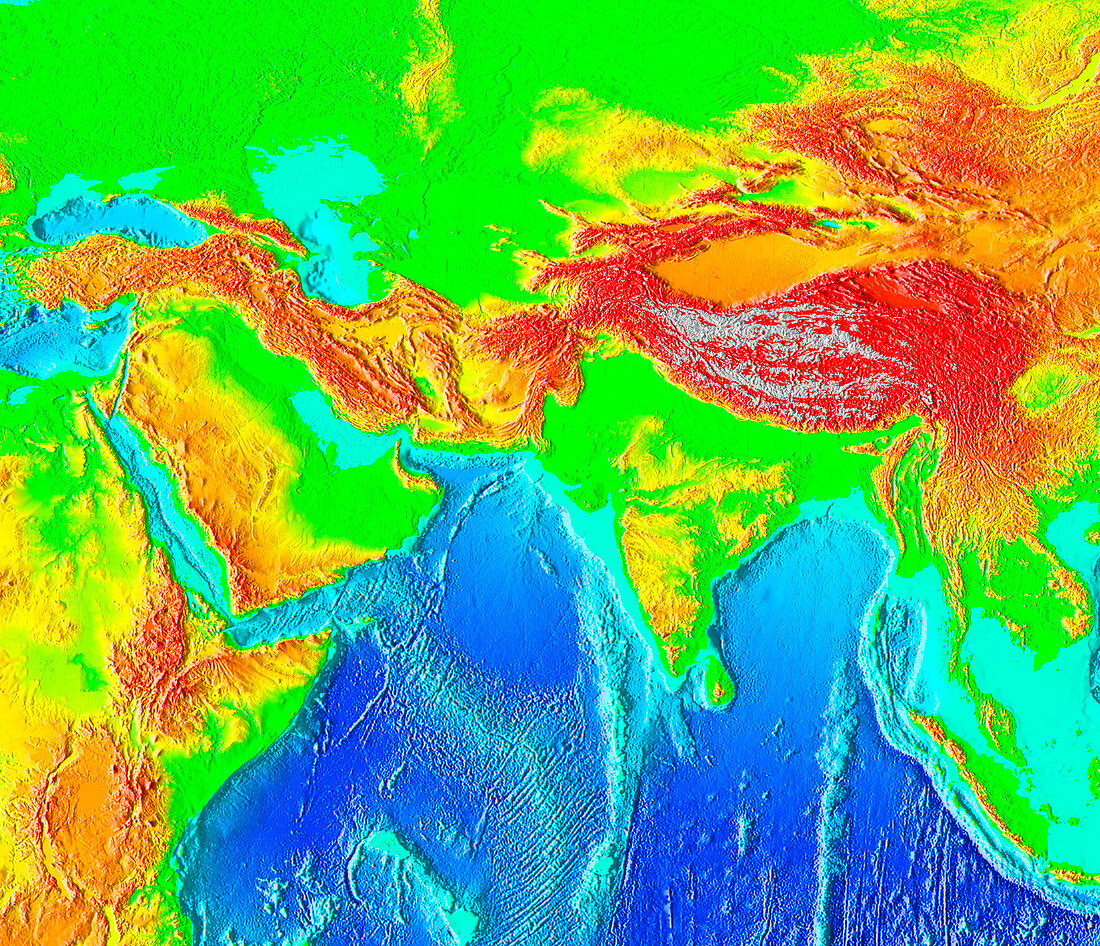
| Southern Asia,topographical map. Elevation is colour-coded. On land,the lowest areas are green,with yellow,orange,red and finally grey indicating increasing elevation. The highest point on Earth,Mount Everest at 8848 metres,is in the Himalaya mountain range at upper right. In the oceans,the shallow waters of the continental shelf are turquoise,with deeper blues indicating deeper water. The Great Rift Valley is seen running from Lebanon (upper left) down through the Red Sea and east Africa. The Rift is where three continental plates are moving apart | |
| Lizenzart: | Lizenzpflichtig |
| Credit: | Science Photo Library / NOAA |
| Bildgröße: | 2520 px × 2168 px |
| Modell-Rechte: | nicht erforderlich |
| Eigentums-Rechte: | nicht erforderlich |
| Restrictions: |
|
Preise für dieses Bild ab 15 €
Universitäten & Organisationen
(Informationsmaterial Digital, Informationsmaterial Print, Lehrmaterial Digital etc.)
ab 15 €
Redaktionell
(Bücher, Bücher: Sach- und Fachliteratur, Digitale Medien (redaktionell) etc.)
ab 30 €
Werbung
(Anzeigen, Aussenwerbung, Digitale Medien, Fernsehwerbung, Karten, Werbemittel, Zeitschriften etc.)
ab 55 €
Handelsprodukte
(bedruckte Textilie, Kalender, Postkarte, Grußkarte, Verpackung etc.)
ab 75 €
Pauschalpreise
Rechtepakete für die unbeschränkte Bildnutzung in Print oder Online
ab 495 €