Great Rift Valley,topographic map
Bildnummer 11735947
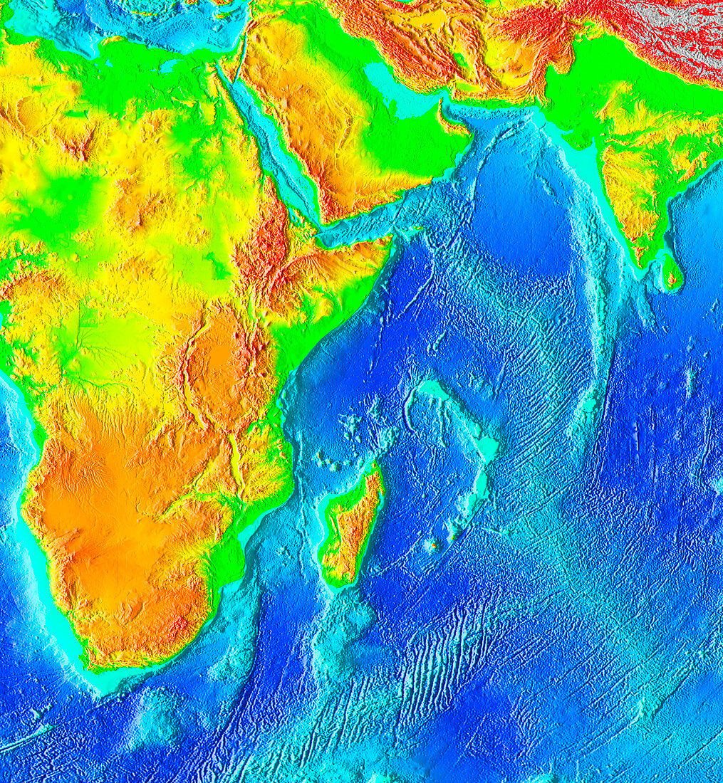
| Great Rift Valley in Africa,topological map. The Great Rift Valley is a 6000-kilometre-long system of valleys that extends from Lebanon (just out of frame at top) to Mozambique (lower left). Topography is colour-coded. In the oceans,the deepest water is dark blue,getting lighter until the shallow continental shelf waters are turquoise. On land the low-lying areas are green,with yellow,orange and finally red indicating increasing elevation. The Rift passes through the Gulf of Aqaba (upper left),through the Red Sea then down through east Africa. The Afar Depression,a triangular feature that contains Africa's lowest point on land,is the yellow/green region between the red highlands just below the Red Sea | |
| Lizenzart: | Lizenzpflichtig |
| Credit: | Science Photo Library / NOAA |
| Bildgröße: | 2296 px × 2488 px |
| Modell-Rechte: | nicht erforderlich |
| Eigentums-Rechte: | nicht erforderlich |
| Restrictions: |
|
Preise für dieses Bild ab 15 €
Universitäten & Organisationen
(Informationsmaterial Digital, Informationsmaterial Print, Lehrmaterial Digital etc.)
ab 15 €
Redaktionell
(Bücher, Bücher: Sach- und Fachliteratur, Digitale Medien (redaktionell) etc.)
ab 30 €
Werbung
(Anzeigen, Aussenwerbung, Digitale Medien, Fernsehwerbung, Karten, Werbemittel, Zeitschriften etc.)
ab 55 €
Handelsprodukte
(bedruckte Textilie, Kalender, Postkarte, Grußkarte, Verpackung etc.)
ab 75 €
Pauschalpreise
Rechtepakete für die unbeschränkte Bildnutzung in Print oder Online
ab 495 €