North America,satellite image
Bildnummer 11735937
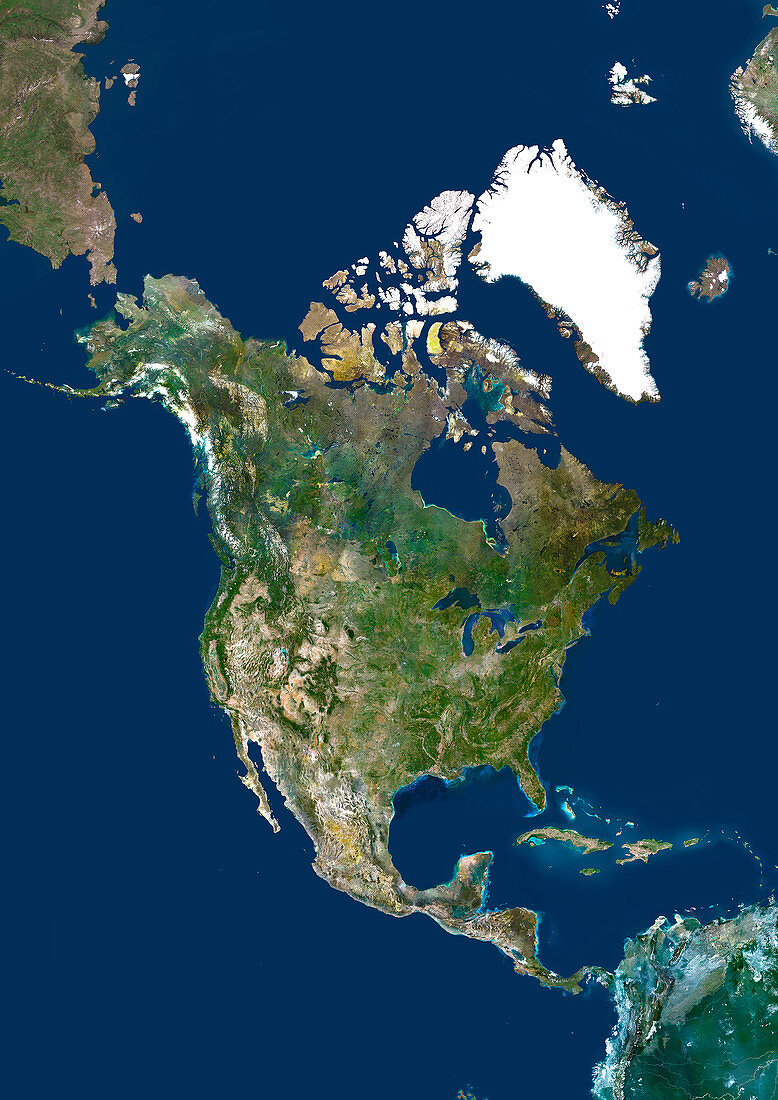
| North America,satellite image. North is at top. Green areas are vegetated. Yellow areas are desert. White areas are ice. The Great Lakes are visible at centre. To their north is the Hudson Bay. To the north of the Hudson Bay are the Arctic,Baffin and Ellesmere Islands and the Greenland ice cap. East of North America is the Atlantic Ocean. In the south is the Caribbean and Central America. The western coast of North America is bounded by the Pacific Ocean | |
| Lizenzart: | Lizenzpflichtig |
| Credit: | Science Photo Library / Planetobserver |
| Bildgröße: | 3508 px × 4961 px |
| Modell-Rechte: | nicht erforderlich |
| Eigentums-Rechte: | nicht erforderlich |
| Restrictions: | - |
Preise für dieses Bild ab 15 €
Universitäten & Organisationen
(Informationsmaterial Digital, Informationsmaterial Print, Lehrmaterial Digital etc.)
ab 15 €
Redaktionell
(Bücher, Bücher: Sach- und Fachliteratur, Digitale Medien (redaktionell) etc.)
ab 30 €
Werbung
(Anzeigen, Aussenwerbung, Digitale Medien, Fernsehwerbung, Karten, Werbemittel, Zeitschriften etc.)
ab 55 €
Handelsprodukte
(bedruckte Textilie, Kalender, Postkarte, Grußkarte, Verpackung etc.)
ab 75 €
Pauschalpreise
Rechtepakete für die unbeschränkte Bildnutzung in Print oder Online
ab 495 €
Keywords
- 1,
- Amerikanisch,
- Arktis,
- Atlantischer Ozean,
- Baffininsel,
- Bild,
- Bilder,
- Eis,
- Erdbeobachtung,
- Erde,
- Erdkunde,
- Foto,
- Fotos,
- geografisch,
- Geographie,
- Große Seen,
- Insel,
- Inseln,
- Karibik,
- Karibisches Meer,
- Kartographie,
- Kontinent,
- Meer,
- Nordamerika,
- nordamerikanisch,
- Ozean,
- Pazifik,
- Satellit,
- Satellitenbild,
- Topographie,
- uns,
- USA,
- Vereinigte Staaten,
- Weltall,
- Wissenschaften,
- Zentralamerika,
- Zusammengesetzt