Lebanon,satellite image
Bildnummer 11735918
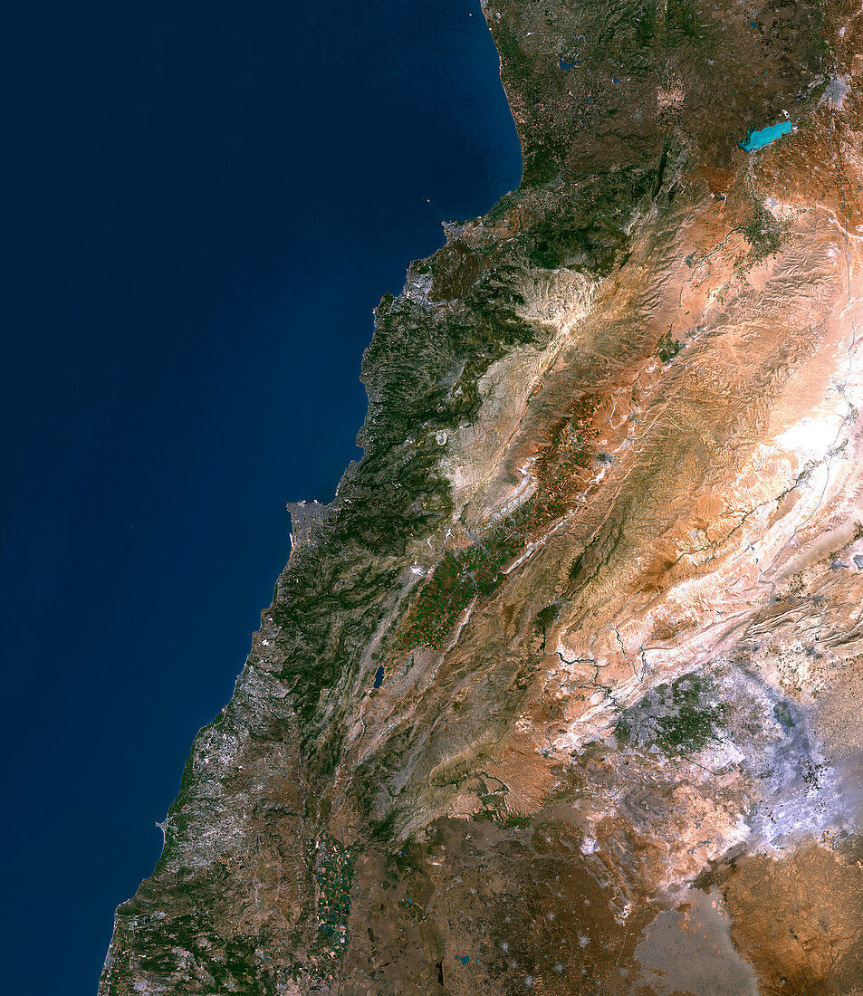
| Lebanon,satellite image. Beirut,the capital city of Lebanon,occupies the triangular peninsula just left of centre. The bright white strip in the south of Beirut is Rafic Hariri International Airport,the only international airport in the country. Much of Lebanon's land is mountainous (brown),with only the coastal regions supporting extensive vegetation (green). The airport and much of the infrastructure of Lebanon were destroyed when Israel invaded the country in July 2006. Photographed on 22nd June 2000 by the Landsat 7 satellite,which orbits at an altitude of 705 kilometres | |
| Lizenzart: | Lizenzpflichtig |
| Credit: | Science Photo Library / Planetobserver |
| Bildgröße: | 4767 px × 5500 px |
| Modell-Rechte: | nicht erforderlich |
| Eigentums-Rechte: | nicht erforderlich |
| Restrictions: | - |
Preise für dieses Bild ab 15 €
Universitäten & Organisationen
(Informationsmaterial Digital, Informationsmaterial Print, Lehrmaterial Digital etc.)
ab 15 €
Redaktionell
(Bücher, Bücher: Sach- und Fachliteratur, Digitale Medien (redaktionell) etc.)
ab 30 €
Werbung
(Anzeigen, Aussenwerbung, Digitale Medien, Fernsehwerbung, Karten, Werbemittel, Zeitschriften etc.)
ab 55 €
Handelsprodukte
(bedruckte Textilie, Kalender, Postkarte, Grußkarte, Verpackung etc.)
ab 75 €
Pauschalpreise
Rechtepakete für die unbeschränkte Bildnutzung in Print oder Online
ab 495 €