North America
Bildnummer 11735890
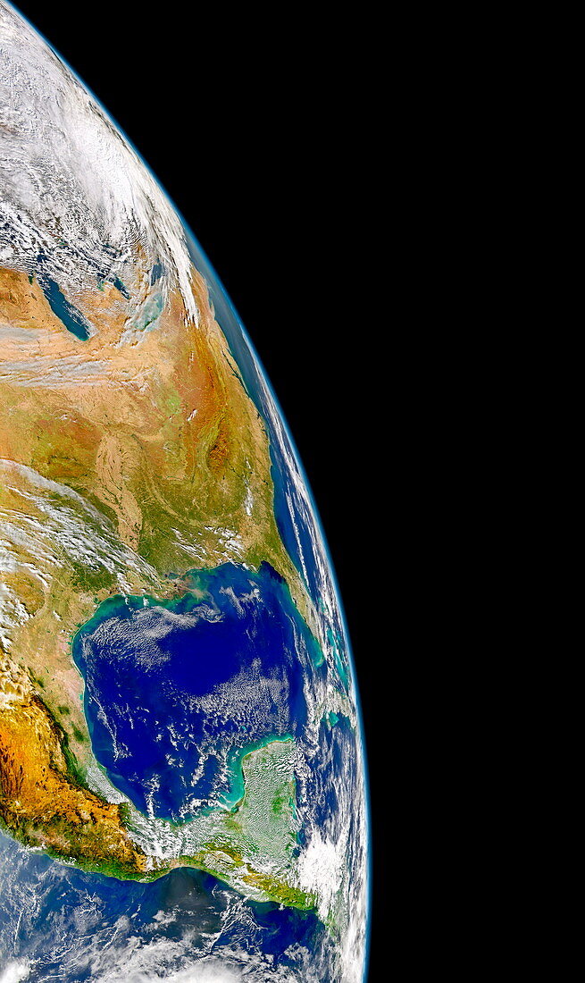
| North America. Satellite image of eastern North America (centre left) and Mexico (lower centre). The Gulf of Mexico is the expanse of water between the two countries. In North America,swaths of fallow croplands can be seen south of the Great Lakes (pink/tan). Also visible are the Appalachian Mountains and Plateau (brown),the Shenandoah Valley (pale green) and the alluvial plain of the Mississippi River (green/tan),which is surrounded in the South by forests (deep green). Image taken by the SeaWiFS Sensor on the OrbView-2 satellite on 7 November 2004 | |
| Lizenzart: | Lizenzpflichtig |
| Credit: | Science Photo Library / Digital Globe |
| Bildgröße: | 2835 px × 4758 px |
| Modell-Rechte: | nicht erforderlich |
| Eigentums-Rechte: | nicht erforderlich |
| Restrictions: | - |
Preise für dieses Bild ab 15 €
Universitäten & Organisationen
(Informationsmaterial Digital, Informationsmaterial Print, Lehrmaterial Digital etc.)
ab 15 €
Redaktionell
(Bücher, Bücher: Sach- und Fachliteratur, Digitale Medien (redaktionell) etc.)
ab 30 €
Werbung
(Anzeigen, Aussenwerbung, Digitale Medien, Fernsehwerbung, Karten, Werbemittel, Zeitschriften etc.)
ab 55 €
Handelsprodukte
(bedruckte Textilie, Kalender, Postkarte, Grußkarte, Verpackung etc.)
ab 75 €
Pauschalpreise
Rechtepakete für die unbeschränkte Bildnutzung in Print oder Online
ab 495 €