North America
Bildnummer 11735875
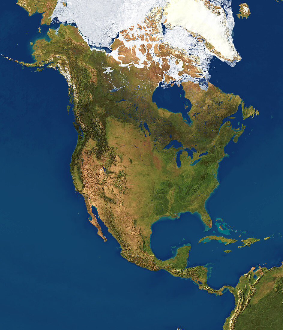
| North America,satellite image. North is at top. Vegetation is green,water is blue,snow and ice are white,and arid land is light brown. Prominent features include the arid land and mountains of the western USA. Dark green forests are seen at upper left and across Canada. The Great Lakes are at centre right,below Hudson Bay. The Arctic ice pack and Greenland are at top. The Pacific Ocean (left) and Atlantic Ocean (right) surround North America. Islands are seen in the Caribbean Sea right of the Gulf of Mexico (lower right). Shallow sand banks appear as pale blue. Part of South America is seen at bottom right | |
| Lizenzart: | Lizenzpflichtig |
| Credit: | Science Photo Library / Planetary Visions |
| Bildgröße: | 3000 px × 3500 px |
| Modell-Rechte: | nicht erforderlich |
| Eigentums-Rechte: | nicht erforderlich |
| Restrictions: | - |
Preise für dieses Bild ab 15 €
Universitäten & Organisationen
(Informationsmaterial Digital, Informationsmaterial Print, Lehrmaterial Digital etc.)
ab 15 €
Redaktionell
(Bücher, Bücher: Sach- und Fachliteratur, Digitale Medien (redaktionell) etc.)
ab 30 €
Werbung
(Anzeigen, Aussenwerbung, Digitale Medien, Fernsehwerbung, Karten, Werbemittel, Zeitschriften etc.)
ab 55 €
Handelsprodukte
(bedruckte Textilie, Kalender, Postkarte, Grußkarte, Verpackung etc.)
ab 75 €
Pauschalpreise
Rechtepakete für die unbeschränkte Bildnutzung in Print oder Online
ab 495 €
Keywords
- 1,
- Alaska,
- Amerikanisch,
- Arktis,
- Atlantisch,
- Bahamas,
- Baja California,
- Berg,
- Bild,
- Bilder,
- Eis,
- Erdbeobachtung,
- Erdkunde,
- Felsig,
- Florida,
- Foto,
- Fotos,
- geografisch,
- Geographie,
- Golf von Mexiko,
- Große Seen,
- Kanada,
- Kanadisch,
- Karibik,
- Kontinent,
- Kuba,
- Land,
- Meer,
- Nordamerika,
- Ozean,
- Pazifik,
- polar,
- Reichweite,
- Satellit,
- Schnee,
- uns,
- USA,
- Vegetation,
- Vereinigte Staaten,
- Weltall,
- Wissenschaften,
- wolkenfrei,
- wolkenlos,
- Wüste,
- zentral,
- Zusammengesetzt