Europe
Bildnummer 11735874
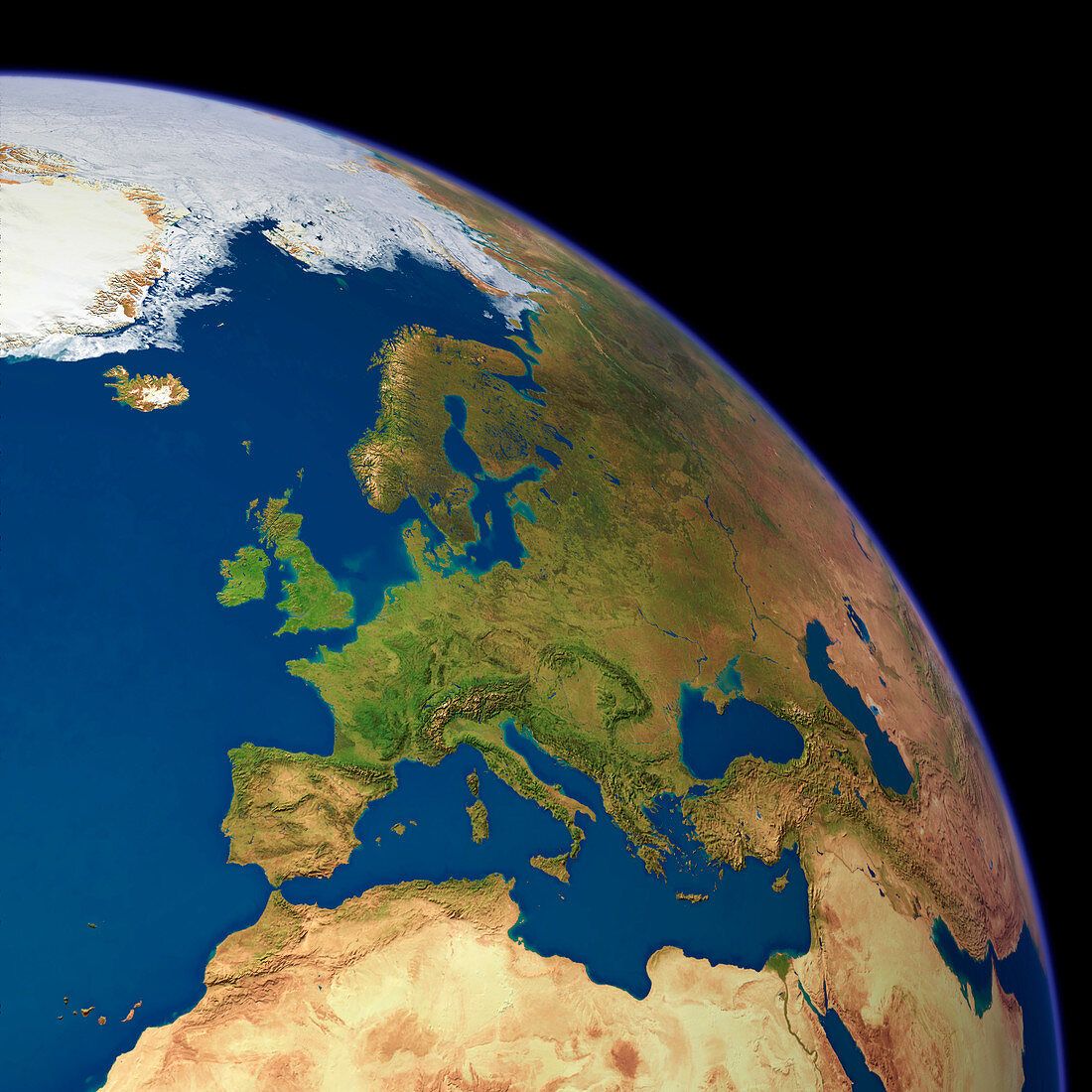
| Europe,satellite image. The North Pole is at top left in the Arctic ice pack (white). Vegetation is green,water is blue and arid land is light brown. Prominent coastal features include the islands of Ireland and Britain (centre left) in the Atlantic Ocean,the Scandinavian Peninsula (upper centre),and the Mediterranean coast and islands (lower centre). The Black Sea is above and right of the Mediterranean Sea. Several mountain chains run in a chain stretching from left to right,from the Pyrenees of northern Spain,to the Alps of central Europe to the Greek mountains and the mountains of Turkey. Deserts are seen in North Africa | |
| Lizenzart: | Lizenzpflichtig |
| Credit: | Science Photo Library / Planetary Visions |
| Bildgröße: | 3000 px × 3000 px |
| Modell-Rechte: | nicht erforderlich |
| Eigentums-Rechte: | nicht erforderlich |
| Restrictions: | - |
Preise für dieses Bild ab 15 €
Universitäten & Organisationen
(Informationsmaterial Digital, Informationsmaterial Print, Lehrmaterial Digital etc.)
ab 15 €
Redaktionell
(Bücher, Bücher: Sach- und Fachliteratur, Digitale Medien (redaktionell) etc.)
ab 30 €
Werbung
(Anzeigen, Aussenwerbung, Digitale Medien, Fernsehwerbung, Karten, Werbemittel, Zeitschriften etc.)
ab 55 €
Handelsprodukte
(bedruckte Textilie, Kalender, Postkarte, Grußkarte, Verpackung etc.)
ab 75 €
Pauschalpreise
Rechtepakete für die unbeschränkte Bildnutzung in Print oder Online
ab 495 €
Keywords
- 1,
- Alpen,
- Arktis,
- baltisch,
- Berg,
- Berge,
- Bild,
- Bilder,
- Bulgarien,
- Deutschland,
- Eis,
- Erdbeobachtung,
- Erdkunde,
- Eurasien,
- Eurasisch,
- Europa,
- europäisch,
- Europäische Union,
- Finnland,
- Foto,
- Fotos,
- Frankreich,
- Gebogen,
- geografisch,
- Geographie,
- Glied,
- Griechenland,
- Großbritannien,
- Island,
- Italien,
- Kaspisch,
- Kontinent,
- Land,
- Meer,
- Mittelmeer,
- Norden,
- Norwegen,
- Ozean,
- polar,
- Polen,
- Reichweite,
- Rumänien,
- Russland,
- Satellit,
- Schnee,
- schwarz,
- Schweden,
- Skandinavien,
- Spanien,
- Truthahn,
- Ukraine,
- Ungarn,
- Vegetation,
- Vereinigtes Königreich,
- Weltall,
- Wissenschaften,
- wolkenfrei,
- wolkenlos,
- Wüste,
- Zusammengesetzt