Eurasia
Bildnummer 11735870
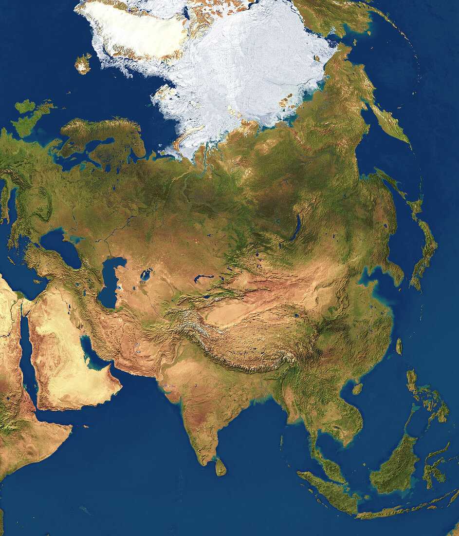
| Eurasia,satellite image. The North Pole is at top in the Arctic ice pack. Water is blue,vegetation is green,ice and snow are white,and arid land is light brown. Prominent features include deserts on the Arabian Peninsula (lower left),and the band of arid land stretching across Asia into China. The Himalayas and other large mountain chains are seen above India (lower centre). Tropical forests cover South-East Asia. The islands of the Malay Archipelago (bottom right) separate the Indian and Pacific oceans. Forests and grass cover northern Asia. The Greenland ice cap is at top left,and Europe is at upper left | |
| Lizenzart: | Lizenzpflichtig |
| Credit: | Science Photo Library / Planetary Visions |
| Bildgröße: | 3000 px × 3500 px |
| Modell-Rechte: | nicht erforderlich |
| Eigentums-Rechte: | nicht erforderlich |
| Restrictions: | - |
Preise für dieses Bild ab 15 €
Universitäten & Organisationen
(Informationsmaterial Digital, Informationsmaterial Print, Lehrmaterial Digital etc.)
ab 15 €
Redaktionell
(Bücher, Bücher: Sach- und Fachliteratur, Digitale Medien (redaktionell) etc.)
ab 30 €
Werbung
(Anzeigen, Aussenwerbung, Digitale Medien, Fernsehwerbung, Karten, Werbemittel, Zeitschriften etc.)
ab 55 €
Handelsprodukte
(bedruckte Textilie, Kalender, Postkarte, Grußkarte, Verpackung etc.)
ab 75 €
Pauschalpreise
Rechtepakete für die unbeschränkte Bildnutzung in Print oder Online
ab 495 €
Keywords
- 1,
- Arabien,
- Arabische Halbinsel,
- Arktis,
- Asiatisch,
- Asien,
- Berg,
- Berge,
- Bild,
- Bilder,
- China,
- Eis,
- Erdbeobachtung,
- Erdkunde,
- Eurasien,
- Eurasisch,
- Europa,
- europäisch,
- Foto,
- Fotos,
- geografisch,
- Geographie,
- Himalaya,
- Indien,
- Indisch,
- Indonesien,
- Japan,
- Kaspisch,
- Kontinent,
- Land,
- Malaiischer Archipel,
- Malaysia,
- Meer,
- Mittlerer Osten,
- Nordpol,
- Ozean,
- polar,
- Regenwald,
- Reichweite,
- Russland,
- Satellit,
- Schnee,
- schwarz,
- Sibirien,
- Vegetation,
- Wald,
- Wälder,
- Weltall,
- Wissenschaften,
- wolkenfrei,
- wolkenlos,
- Wüste,
- Zusammengesetzt