Southern Iraq
Bildnummer 11735860
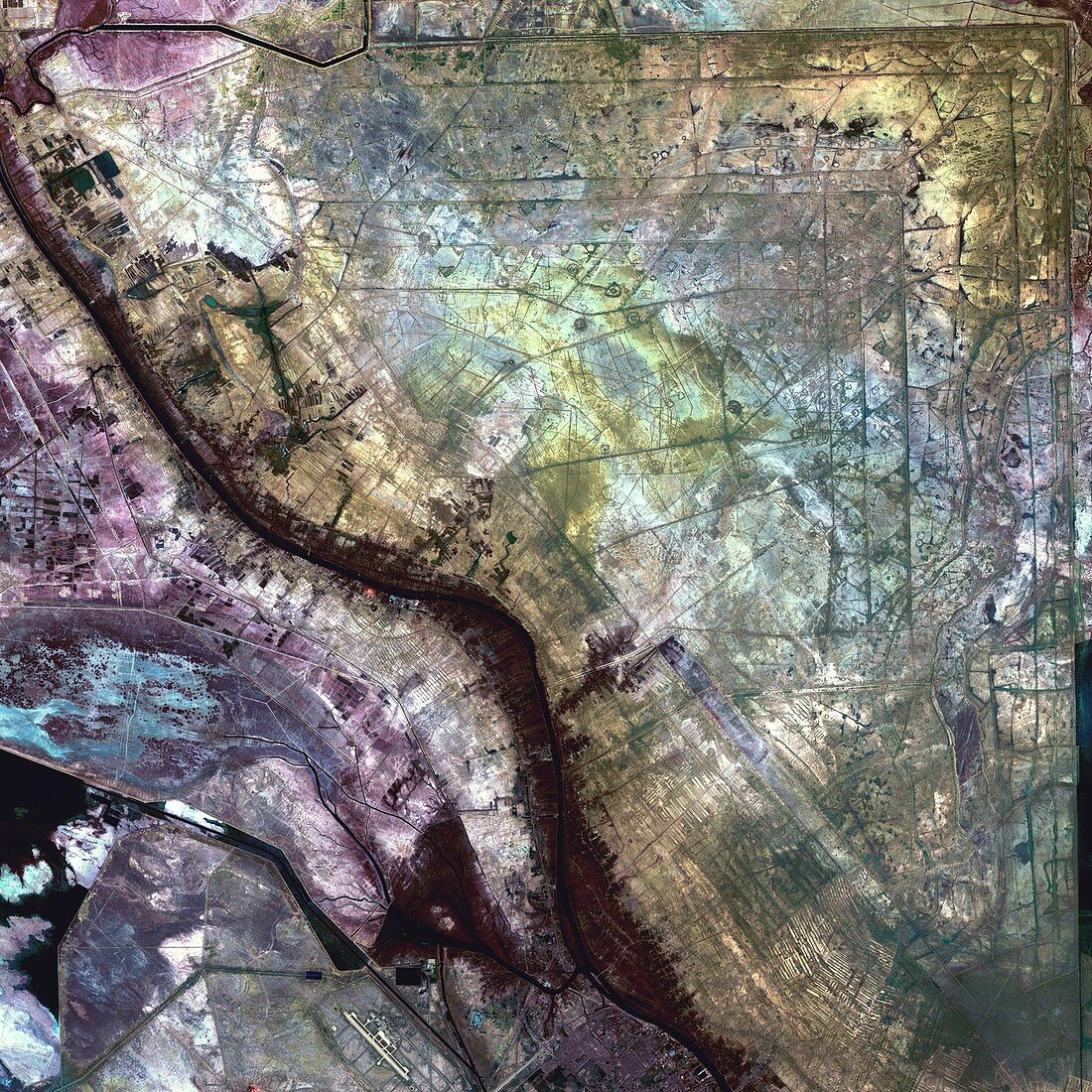
| Southern Iraq,satellite image. North is at top. This is the Al Basrah region of the country,which lies at its southeast corner. This region borders the countries of Iran (to the east) and Kuwait (to the south). This area was a former wetland that has been drained and walled off. It is now a military training area that has numerous minefields and gun encampments. This photograph was taken on 24 January 2001,with the Enhanced Thematic Mapper plus (ETM+) sensor aboard NASA's Landsat 7 satellite | |
| Lizenzart: | Lizenzpflichtig |
| Credit: | Science Photo Library / NASA |
| Bildgröße: | 3600 px × 3600 px |
| Modell-Rechte: | nicht erforderlich |
| Eigentums-Rechte: | nicht erforderlich |
| Restrictions: | - |
Preise für dieses Bild ab 15 €
Universitäten & Organisationen
(Informationsmaterial Digital, Informationsmaterial Print, Lehrmaterial Digital etc.)
ab 15 €
Redaktionell
(Bücher, Bücher: Sach- und Fachliteratur, Digitale Medien (redaktionell) etc.)
ab 30 €
Werbung
(Anzeigen, Aussenwerbung, Digitale Medien, Fernsehwerbung, Karten, Werbemittel, Zeitschriften etc.)
ab 55 €
Handelsprodukte
(bedruckte Textilie, Kalender, Postkarte, Grußkarte, Verpackung etc.)
ab 75 €
Pauschalpreise
Rechtepakete für die unbeschränkte Bildnutzung in Print oder Online
ab 495 €
Keywords
- Bild,
- Bilder,
- Bodennutzung,
- Erdkunde,
- farbig,
- Feuchtgebiet,
- Foto,
- Fotos,
- geografisch,
- Geographie,
- infrarot,
- ir,
- Irak,
- Iran,
- Januar,
- Land,
- Landsat 7,
- Mittlerer Osten,
- optisch,
- Pflanzen,
- Rand,
- Satellit,
- Sichtbar,
- Süd-,
- Süden,
- Vegetation,
- Weltall,
- Wissenschaften