Albania
Bildnummer 11735844
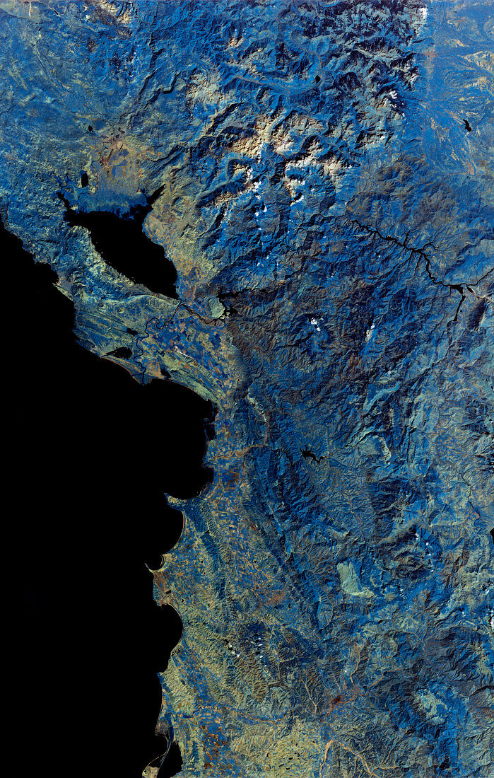
| Albania-Yugoslavia border,infrared satellite image. North is at top. Vegetation is blue,barren or sparsely vegetated land is green/brown,water is black and clouds are white. Cultivated fields are seen on the shores of the Adriatic Sea,while the rugged mountains inland are covered in forests (blue) at higher elevations. Albania takes up most of the image,with Yugoslavia across top. The Albania-Yugoslavia border runs through Lake Scutari (upper left). This 180-kilometre-wide image was taken on 10 September 1984,in infrared wavelengths,with the Thematic Mapper (TM) sensor on a NASA Landsat satellite | |
| Lizenzart: | Lizenzpflichtig |
| Credit: | Science Photo Library / MDA Information Systems |
| Bildgröße: | 3330 px × 5244 px |
| Modell-Rechte: | nicht erforderlich |
| Eigentums-Rechte: | nicht erforderlich |
| Restrictions: | - |
Preise für dieses Bild ab 15 €
Universitäten & Organisationen
(Informationsmaterial Digital, Informationsmaterial Print, Lehrmaterial Digital etc.)
ab 15 €
Redaktionell
(Bücher, Bücher: Sach- und Fachliteratur, Digitale Medien (redaktionell) etc.)
ab 30 €
Werbung
(Anzeigen, Aussenwerbung, Digitale Medien, Fernsehwerbung, Karten, Werbemittel, Zeitschriften etc.)
ab 55 €
Handelsprodukte
(bedruckte Textilie, Kalender, Postkarte, Grußkarte, Verpackung etc.)
ab 75 €
Pauschalpreise
Rechtepakete für die unbeschränkte Bildnutzung in Print oder Online
ab 495 €
Keywords
- Albanien,
- Albanisch,
- Anbau,
- Bauernhöfe,
- Berg,
- Berge,
- bewaldet,
- Bild,
- Bilder,
- Bodennutzung,
- Erdkunde,
- Europa,
- europäisch,
- farbig,
- Felder,
- Foto,
- Fotos,
- geografisch,
- Geographie,
- Grenzen,
- infrarot,
- ir,
- Jugoslawien,
- kultiviert,
- Küste,
- Küsten-,
- Küstenlinie,
- Land,
- Länder,
- Landwirtschaft,
- landwirtschaftlich,
- Meer,
- Mittelmeer,
- montan,
- Nation,
- Nationen,
- Rand,
- Satellit,
- September,
- Serbien,
- Serbisch,
- Tm,
- Vertikal,
- Wälder,
- Wasser,
- Weltall,
- Wissenschaften