Northern Europe
Bildnummer 11735836
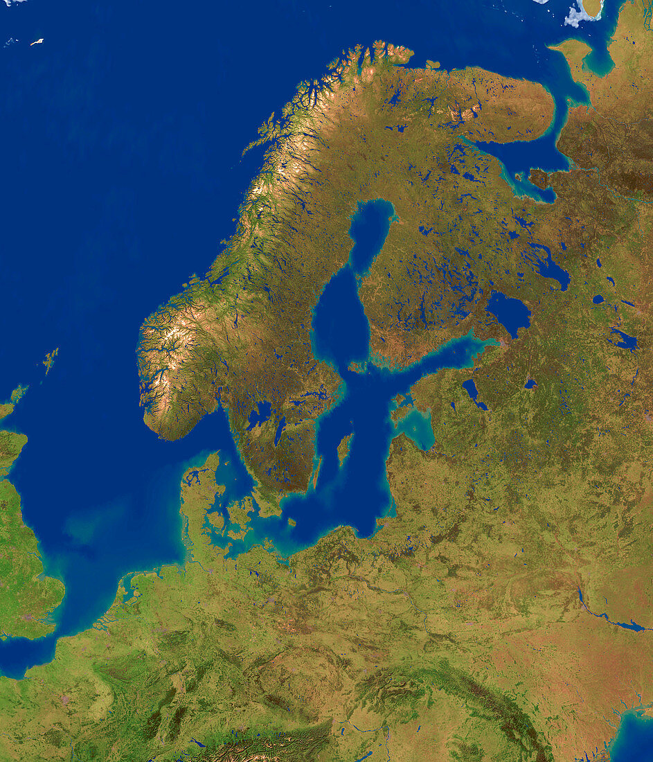
| Northern Europe,computer model based on satellite data. North is at top,the Swedish island of Gotland in the Baltic Sea is at centre. Water is blue,bare land is brown and vegetation is green. The North Sea (centre left),Norwegian Sea (upper left) and Barents Sea (across top) are seen. The pitted western coast of Scandinavia (upper centre) shows the fjords of Norway | |
| Lizenzart: | Lizenzpflichtig |
| Credit: | Science Photo Library / Planetary Visions |
| Bildgröße: | 3000 px × 3500 px |
| Modell-Rechte: | nicht erforderlich |
| Eigentums-Rechte: | nicht erforderlich |
| Restrictions: | - |
Preise für dieses Bild ab 15 €
Universitäten & Organisationen
(Informationsmaterial Digital, Informationsmaterial Print, Lehrmaterial Digital etc.)
ab 15 €
Redaktionell
(Bücher, Bücher: Sach- und Fachliteratur, Digitale Medien (redaktionell) etc.)
ab 30 €
Werbung
(Anzeigen, Aussenwerbung, Digitale Medien, Fernsehwerbung, Karten, Werbemittel, Zeitschriften etc.)
ab 55 €
Handelsprodukte
(bedruckte Textilie, Kalender, Postkarte, Grußkarte, Verpackung etc.)
ab 75 €
Pauschalpreise
Rechtepakete für die unbeschränkte Bildnutzung in Print oder Online
ab 495 €
Keywords
- baltisch,
- Bild,
- Bilder,
- Bildgebung,
- Computermodell,
- Daten,
- Erde,
- Erdkunde,
- Europa,
- europäisch,
- farbig,
- Fjord,
- Fjorde,
- Foto,
- Fotos,
- geografisch,
- Geographie,
- Gotland,
- Insel,
- Inseln,
- Karte,
- Kartographie,
- Kontinent,
- Land,
- Modelling,
- Nordsee,
- Norwegen,
- Norwegisch,
- Satellitenbild,
- Skandinavien,
- Skandinavisch,
- topografisch,
- Topographie,
- topographisch,
- Vegetation,
- Wasser,
- Weltall,
- Wissenschaften