Africa and Eurasia
Bildnummer 11735823
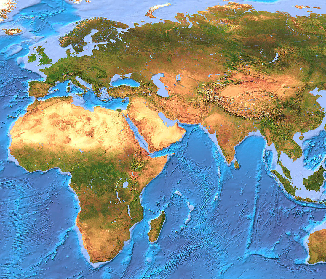
| Africa and Eurasia. Coloured computer model of Africa and Eurasia from space,based on satellite data. North is at top. Vegetation is green,bare land is brown and water is blue. To the west of Africa (lower left) lies the Atlantic Ocean. The Indian Ocean (lower right) is surrounded by Africa,Eurasia (across top) and Australasia (lower right,only partially seen). Extensive deserts (yellow) are seen stretching across northern Africa and the Arabian peninsula (centre left). The topography of the ocean floors is shown in varying shades of blue | |
| Lizenzart: | Lizenzpflichtig |
| Credit: | Science Photo Library / Planetary Visions |
| Bildgröße: | 3500 px × 3000 px |
| Modell-Rechte: | nicht erforderlich |
| Eigentums-Rechte: | nicht erforderlich |
| Restrictions: | - |
Preise für dieses Bild ab 15 €
Universitäten & Organisationen
(Informationsmaterial Digital, Informationsmaterial Print, Lehrmaterial Digital etc.)
ab 15 €
Redaktionell
(Bücher, Bücher: Sach- und Fachliteratur, Digitale Medien (redaktionell) etc.)
ab 30 €
Werbung
(Anzeigen, Aussenwerbung, Digitale Medien, Fernsehwerbung, Karten, Werbemittel, Zeitschriften etc.)
ab 55 €
Handelsprodukte
(bedruckte Textilie, Kalender, Postkarte, Grußkarte, Verpackung etc.)
ab 75 €
Pauschalpreise
Rechtepakete für die unbeschränkte Bildnutzung in Print oder Online
ab 495 €
Keywords
- 1,
- Afrika,
- Asien,
- Atlantisch,
- Bathymetrie,
- Bild,
- Bilder,
- Bildgebung,
- Computermodell,
- Daten,
- Eis,
- Erdkunde,
- Eurasien,
- Europa,
- farbig,
- geografisch,
- Geographie,
- Indisch,
- Karte,
- Kartographie,
- Kontinent,
- Kontinente,
- Land,
- Meer,
- Modelling,
- nackt,
- Ozean,
- Ozeane,
- Satellitenbild,
- Schnee,
- Topographie,
- trocken,
- Vegetation,
- Wasser,
- Weltall,
- Wissenschaften,
- Wüste