Europe
Bildnummer 11735814
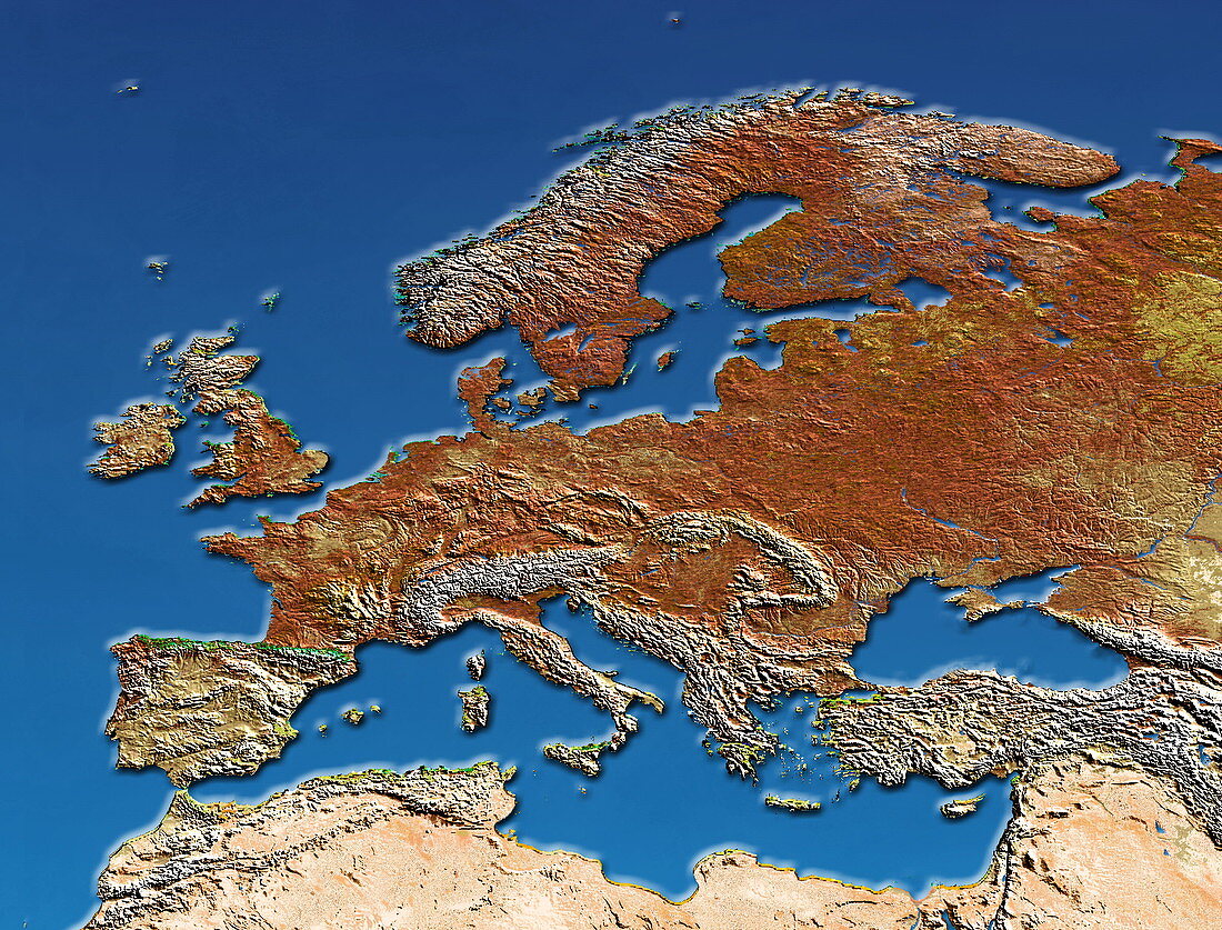
| Europe,coloured satellite image. North is at top. Water is blue and varying shades of brown show the topography of the land. The Mediterranean Sea (lower centre) separates Europe from the deserts (pale brown,across bottom) of northern Africa. The northern coasts of the Mediterranean and parts of central Europe are seen crumpled into mountain ranges (white). These mountains include the Alps (centre left) and the rugged terrain of Turkey (lower right),which lies south of the Black Sea (blue,above and right of the Mediterranean Sea). Mountain ranges also line the western coast of the Scandinavian Peninsula (upper centre) | |
| Lizenzart: | Lizenzpflichtig |
| Credit: | Science Photo Library / Dynamic Earth Imaging |
| Bildgröße: | 3050 px × 2321 px |
| Modell-Rechte: | nicht erforderlich |
| Eigentums-Rechte: | nicht erforderlich |
| Restrictions: | - |
Preise für dieses Bild ab 15 €
Universitäten & Organisationen
(Informationsmaterial Digital, Informationsmaterial Print, Lehrmaterial Digital etc.)
ab 15 €
Redaktionell
(Bücher, Bücher: Sach- und Fachliteratur, Digitale Medien (redaktionell) etc.)
ab 30 €
Werbung
(Anzeigen, Aussenwerbung, Digitale Medien, Fernsehwerbung, Karten, Werbemittel, Zeitschriften etc.)
ab 55 €
Handelsprodukte
(bedruckte Textilie, Kalender, Postkarte, Grußkarte, Verpackung etc.)
ab 75 €
Pauschalpreise
Rechtepakete für die unbeschränkte Bildnutzung in Print oder Online
ab 495 €
Keywords
- Afrika,
- Atlantisch,
- Berge,
- Bergkette,
- Bild,
- Bilder,
- Britische Inseln,
- Erdkunde,
- Europa,
- farbig,
- Foto,
- Fotos,
- geografisch,
- Geographie,
- Halbinsel,
- Insel,
- Inseln,
- Karte,
- Kontinent,
- Land,
- Linderung,
- Meer,
- Mittelmeer,
- Norden,
- Ozean,
- Satellitenbild,
- schwarz,
- Skandinavien,
- topografisch,
- Topographie,
- topographisch,
- trocken,
- Truthahn,
- Wasser,
- Weltall,
- Wissenschaften,
- Wüste