India
Bildnummer 11735762
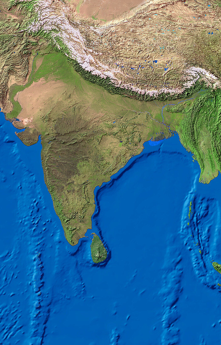
| India. True-colour satellite image of the Indian sub-continent. North is at top. Vegetation is green,arid areas are brown and water is blue. India is bounded by Pakistan to the west,which lies beyond the Rajasthan deserts (upper left). At north,are the snow-capped (white) peaks of the Himalayas and Karakoram mountain ranges with Nepal and the high plateau of Tibet beyond. To the east,Bangladesh lies between India and the country of Myanmar (bright green). The island country of Sri Lanka (lower centre) lies in the Indian Ocean | |
| Lizenzart: | Lizenzpflichtig |
| Credit: | Science Photo Library / Worldsat International |
| Bildgröße: | 4000 px × 6252 px |
| Modell-Rechte: | nicht erforderlich |
| Eigentums-Rechte: | nicht erforderlich |
| Restrictions: |
|
Preise für dieses Bild ab 15 €
Universitäten & Organisationen
(Informationsmaterial Digital, Informationsmaterial Print, Lehrmaterial Digital etc.)
ab 15 €
Redaktionell
(Bücher, Bücher: Sach- und Fachliteratur, Digitale Medien (redaktionell) etc.)
ab 30 €
Werbung
(Anzeigen, Aussenwerbung, Digitale Medien, Fernsehwerbung, Karten, Werbemittel, Zeitschriften etc.)
ab 55 €
Handelsprodukte
(bedruckte Textilie, Kalender, Postkarte, Grußkarte, Verpackung etc.)
ab 75 €
Pauschalpreise
Rechtepakete für die unbeschränkte Bildnutzung in Print oder Online
ab 495 €
Keywords
- 1,
- Berge,
- Bild,
- Bilder,
- Eis,
- Erdkunde,
- Foto,
- Fotos,
- geografisch,
- Geographie,
- Himalaya,
- Indisch,
- Land,
- Länder,
- Myanmar,
- Nepal,
- Observation,
- Ozeane,
- Rajasthan,
- Satellitenbilder,
- Schnee,
- Sri Lanka,
- Tibet,
- topografisch,
- Topographie,
- Vegetation,
- Wasser,
- Weltall,
- Wissenschaften