Europe
Bildnummer 11735745
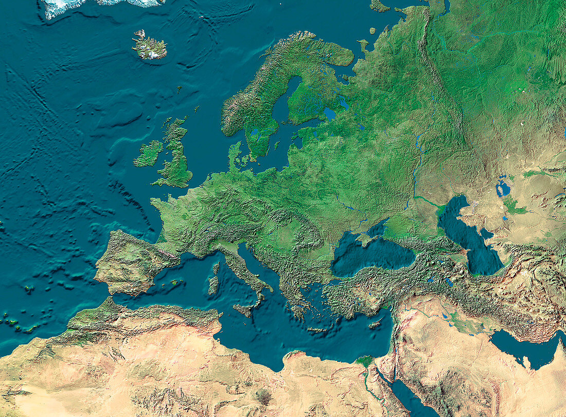
| Europe. True-colour satellite image of Europe and northern Africa. North is at top. Vegetation is green,arid areas are brown and water is blue. Extensive deserts are seen stretching across northern Africa and the Arabian peninsula. The topography of the ocean floors is clearly shown. The Mediterranean Sea (lower centre) separates Europe from Africa. The Black Sea (centre right) is connected to the Mediterranean Sea,while the Caspian Sea (far right) is landlocked,making it the largest inland sea in the world | |
| Lizenzart: | Lizenzpflichtig |
| Credit: | Science Photo Library / Worldsat International |
| Bildgröße: | 3300 px × 2433 px |
| Modell-Rechte: | nicht erforderlich |
| Eigentums-Rechte: | nicht erforderlich |
| Restrictions: |
|
Preise für dieses Bild ab 15 €
Universitäten & Organisationen
(Informationsmaterial Digital, Informationsmaterial Print, Lehrmaterial Digital etc.)
ab 15 €
Redaktionell
(Bücher, Bücher: Sach- und Fachliteratur, Digitale Medien (redaktionell) etc.)
ab 30 €
Werbung
(Anzeigen, Aussenwerbung, Digitale Medien, Fernsehwerbung, Karten, Werbemittel, Zeitschriften etc.)
ab 55 €
Handelsprodukte
(bedruckte Textilie, Kalender, Postkarte, Grußkarte, Verpackung etc.)
ab 75 €
Pauschalpreise
Rechtepakete für die unbeschränkte Bildnutzung in Print oder Online
ab 495 €