Scandinavia
Bildnummer 11735740
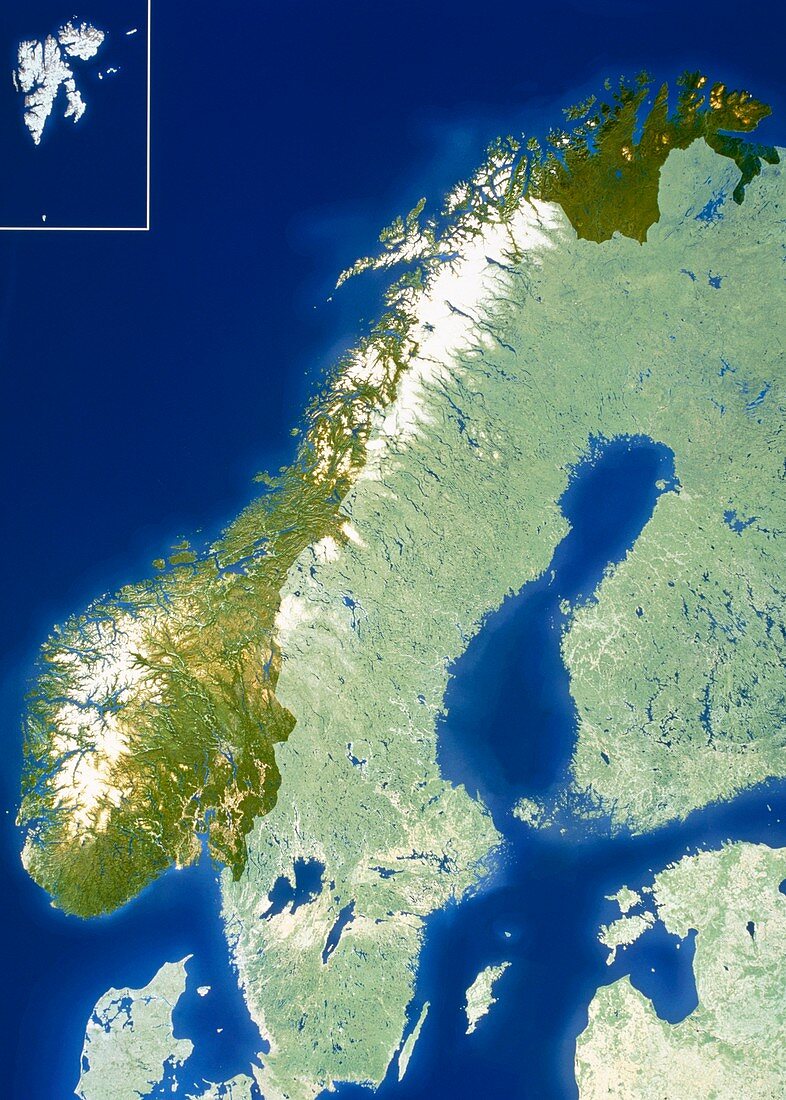
| Scandinavia. True-colour satellite image of part of Scandinavia. North is at top. Water is blue,vegetation is green and snow is white. Norway is seen in brighter colours. Scandinavia consists of Norway,Sweden (down centre),Denmark (partially visible at bottom left) and Iceland (not seen). The Norwegian island group Svalbard lies in the box at top left. In reality the islands lie further to the north. Estonia is to the north of Latvia at bottom right,while Finland (at centre and upper right) is also seen. At lower right is the Baltic Sea,an almost totally enclosed body of water. The Norwegian Sea is at upper left | |
| Lizenzart: | Lizenzpflichtig |
| Credit: | Science Photo Library / Planetobserver |
| Bildgröße: | 3611 px × 5053 px |
| Modell-Rechte: | nicht erforderlich |
| Eigentums-Rechte: | nicht erforderlich |
| Restrictions: | - |
Preise für dieses Bild ab 15 €
Universitäten & Organisationen
(Informationsmaterial Digital, Informationsmaterial Print, Lehrmaterial Digital etc.)
ab 15 €
Redaktionell
(Bücher, Bücher: Sach- und Fachliteratur, Digitale Medien (redaktionell) etc.)
ab 30 €
Werbung
(Anzeigen, Aussenwerbung, Digitale Medien, Fernsehwerbung, Karten, Werbemittel, Zeitschriften etc.)
ab 55 €
Handelsprodukte
(bedruckte Textilie, Kalender, Postkarte, Grußkarte, Verpackung etc.)
ab 75 €
Pauschalpreise
Rechtepakete für die unbeschränkte Bildnutzung in Print oder Online
ab 495 €