True-colour LANDSAT image of Central America
Bildnummer 11735732
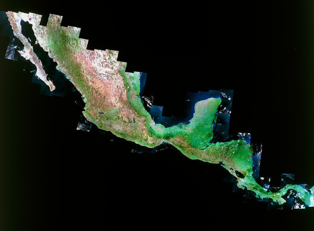
| Central America. True-colour LANDSAT satellite mosaic image of Central America. North is at top. Vegetation is green,with water blue/black and bare ground pink/white. Mexico runs from the rod- like Baja California (top left) down to the Yucatan Peninsula (protruding northwards at lower right). At upper centre is the Gulf of Mexico,with the Atlantic Ocean at right and the Pacific Ocean at lower left. South of Mexico are Belize,Guatemala,Honduras,El Salvador,Nicaragua (containing the lake at lower right),Costa Rica and Panama (the narrow strip of land at bottom right). LANDSAT is an American satellite | |
| Lizenzart: | Lizenzpflichtig |
| Credit: | Science Photo Library / MDA Information Systems |
| Bildgröße: | 5101 px × 3758 px |
| Modell-Rechte: | nicht erforderlich |
| Eigentums-Rechte: | nicht erforderlich |
| Restrictions: | - |
Preise für dieses Bild ab 15 €
Universitäten & Organisationen
(Informationsmaterial Digital, Informationsmaterial Print, Lehrmaterial Digital etc.)
ab 15 €
Redaktionell
(Bücher, Bücher: Sach- und Fachliteratur, Digitale Medien (redaktionell) etc.)
ab 30 €
Werbung
(Anzeigen, Aussenwerbung, Digitale Medien, Fernsehwerbung, Karten, Werbemittel, Zeitschriften etc.)
ab 55 €
Handelsprodukte
(bedruckte Textilie, Kalender, Postkarte, Grußkarte, Verpackung etc.)
ab 75 €
Pauschalpreise
Rechtepakete für die unbeschränkte Bildnutzung in Print oder Online
ab 495 €