Coloured satellite image of North America
Bildnummer 11735726
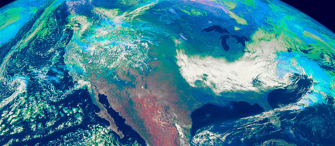
| North America. Coloured satellite image of North America. North is at top. Clouds appear white,green and blue. The Atlantic (at right) and Pacific Oceans (at left) are dark blue. The five Great Lakes are also visible at upper right. Areas of vegetation are green,red and blue,while bare ground is brown. This image was taken by GOES-10 (Geostationary Operational Environmental Satellite) on 4 April 1998. GOES-10 is operated by the US National Oceanic and Atmospheric Administration (NOAA) | |
| Lizenzart: | Lizenzpflichtig |
| Credit: | Science Photo Library / NASA's Goddard Space Flight Center |
| Bildgröße: | 4864 px × 2125 px |
| Modell-Rechte: | nicht erforderlich |
| Eigentums-Rechte: | nicht erforderlich |
| Restrictions: | - |
Preise für dieses Bild ab 15 €
Universitäten & Organisationen
(Informationsmaterial Digital, Informationsmaterial Print, Lehrmaterial Digital etc.)
ab 15 €
Redaktionell
(Bücher, Bücher: Sach- und Fachliteratur, Digitale Medien (redaktionell) etc.)
ab 30 €
Werbung
(Anzeigen, Aussenwerbung, Digitale Medien, Fernsehwerbung, Karten, Werbemittel, Zeitschriften etc.)
ab 55 €
Handelsprodukte
(bedruckte Textilie, Kalender, Postkarte, Grußkarte, Verpackung etc.)
ab 75 €
Pauschalpreise
Rechtepakete für die unbeschränkte Bildnutzung in Print oder Online
ab 495 €