Digital shaded-relief map of the continental USA
Bildnummer 11735722
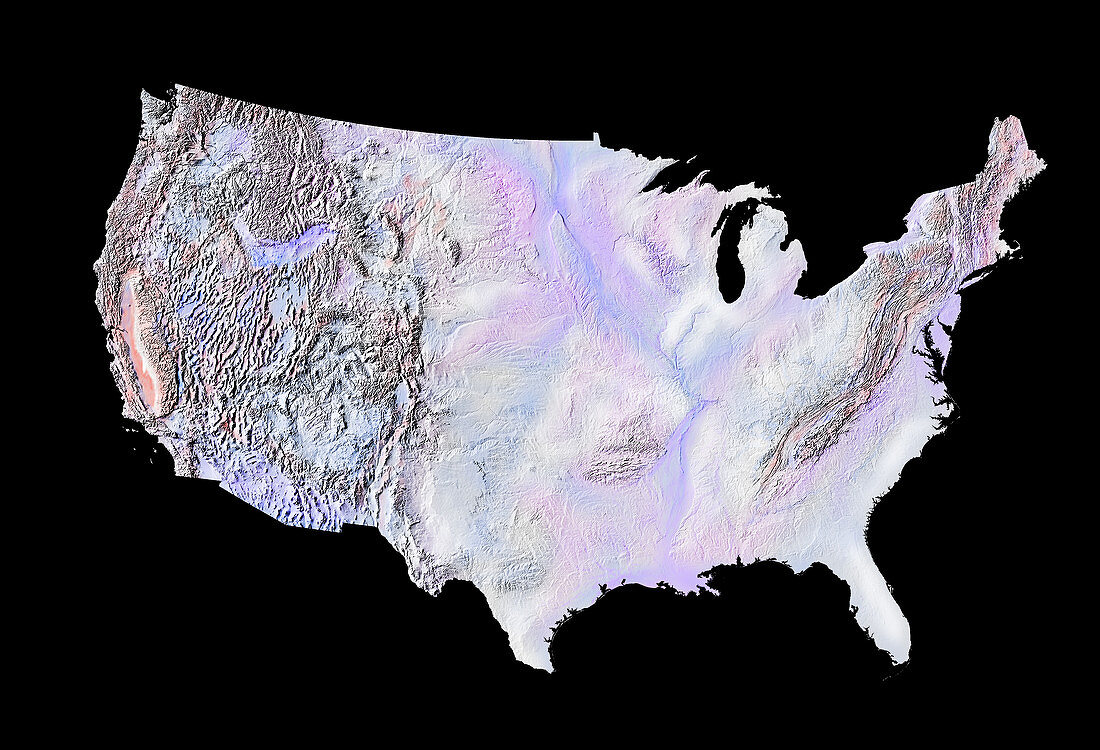
| United States relief map. Digital shaded-relief map of the continental USA. The Appalachian Mountains lie to the East (at right) and various other highland areas are visible in the West. The outline of the Great Lakes (black) can be seen at upper right. Relief is shown by shadows cast by a simulated Sun in the West. This is known as hill shading. This terrain map,made up of 12 million 1/2 mile by 1/2 mile squares,was created from heights taken from topographic maps. The brightness of each square is based on the relationship of the angle and direction of the slope to the simulated Sun. This map was made by the United States Geological Survey (USGS) | |
| Lizenzart: | Lizenzpflichtig |
| Credit: | Science Photo Library / US Geological Survey |
| Bildgröße: | 3500 px × 2386 px |
| Modell-Rechte: | nicht erforderlich |
| Eigentums-Rechte: | nicht erforderlich |
| Restrictions: | - |
Preise für dieses Bild ab 15 €
Universitäten & Organisationen
(Informationsmaterial Digital, Informationsmaterial Print, Lehrmaterial Digital etc.)
ab 15 €
Redaktionell
(Bücher, Bücher: Sach- und Fachliteratur, Digitale Medien (redaktionell) etc.)
ab 30 €
Werbung
(Anzeigen, Aussenwerbung, Digitale Medien, Fernsehwerbung, Karten, Werbemittel, Zeitschriften etc.)
ab 55 €
Handelsprodukte
(bedruckte Textilie, Kalender, Postkarte, Grußkarte, Verpackung etc.)
ab 75 €
Pauschalpreise
Rechtepakete für die unbeschränkte Bildnutzung in Print oder Online
ab 495 €