Cloudless satellite image of Australasia
Bildnummer 11735710
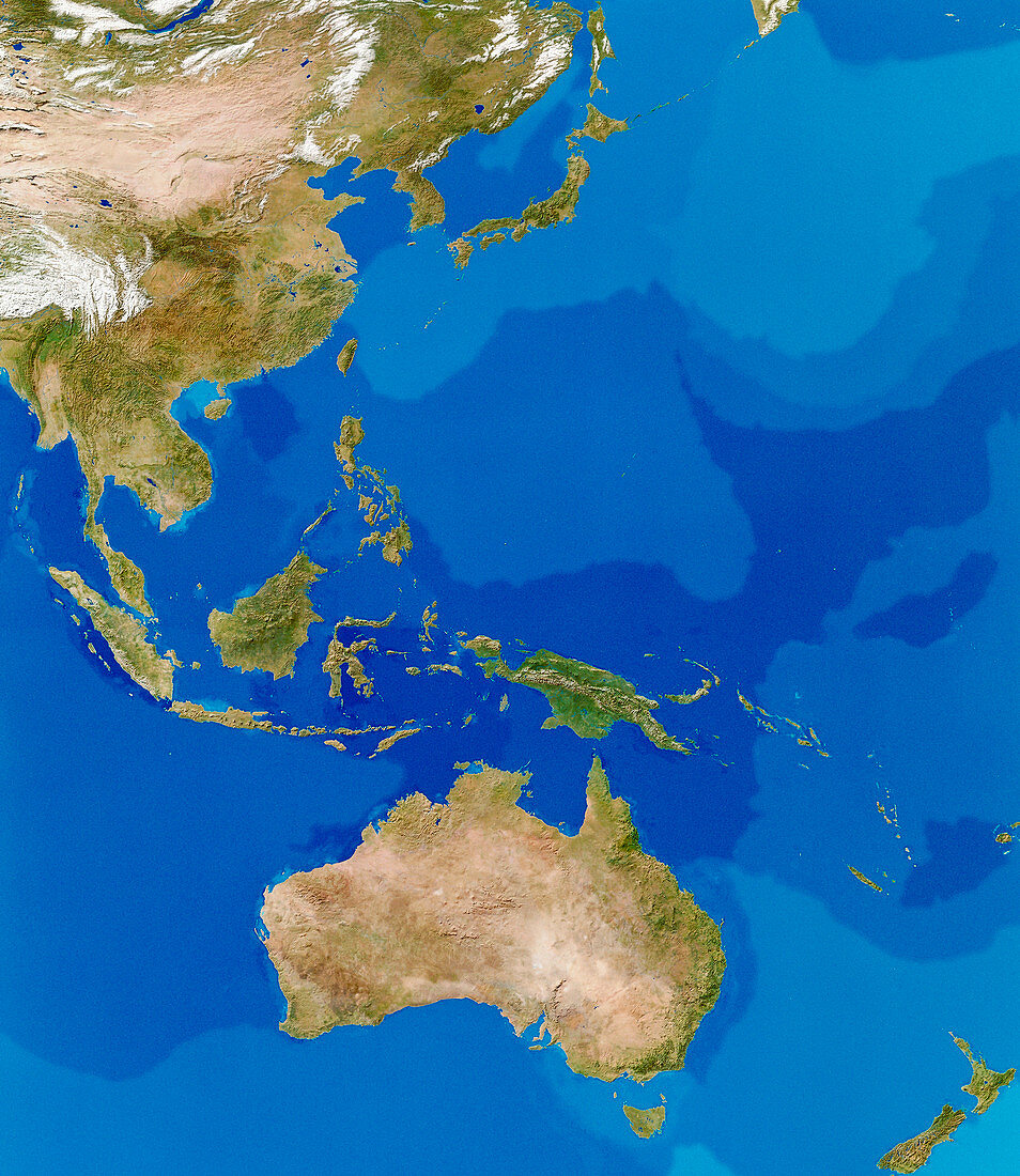
| Australasia. Cloudless satellite image of Australasia. North is at top. The colours of the land approximate to natural tones,whilst blue colour codes represent ocean topography. Australasia contains the continent of Australia (at lower centre),the islands of New Zealand (at bottom right),and the Malay archipelago (from left to centre right). This image was compiled from data acquired by NOAA weather satellites over eleven ten-day periods at an altitude of 833 kilometres to give a resolution of 1 kilometre | |
| Lizenzart: | Lizenzpflichtig |
| Credit: | Science Photo Library / PLANETARY VISIONS / TOM VAN SANT, GEOSPHERE PROJECT |
| Bildgröße: | 3381 px × 3897 px |
| Modell-Rechte: | nicht erforderlich |
| Eigentums-Rechte: | nicht erforderlich |
| Restrictions: |
|
Preise für dieses Bild ab 15 €
Universitäten & Organisationen
(Informationsmaterial Digital, Informationsmaterial Print, Lehrmaterial Digital etc.)
ab 15 €
Redaktionell
(Bücher, Bücher: Sach- und Fachliteratur, Digitale Medien (redaktionell) etc.)
ab 30 €
Werbung
(Anzeigen, Aussenwerbung, Digitale Medien, Fernsehwerbung, Karten, Werbemittel, Zeitschriften etc.)
ab 55 €
Handelsprodukte
(bedruckte Textilie, Kalender, Postkarte, Grußkarte, Verpackung etc.)
ab 75 €
Pauschalpreise
Rechtepakete für die unbeschränkte Bildnutzung in Print oder Online
ab 495 €