Mosaic of satellite images of Europe
Bildnummer 11735701
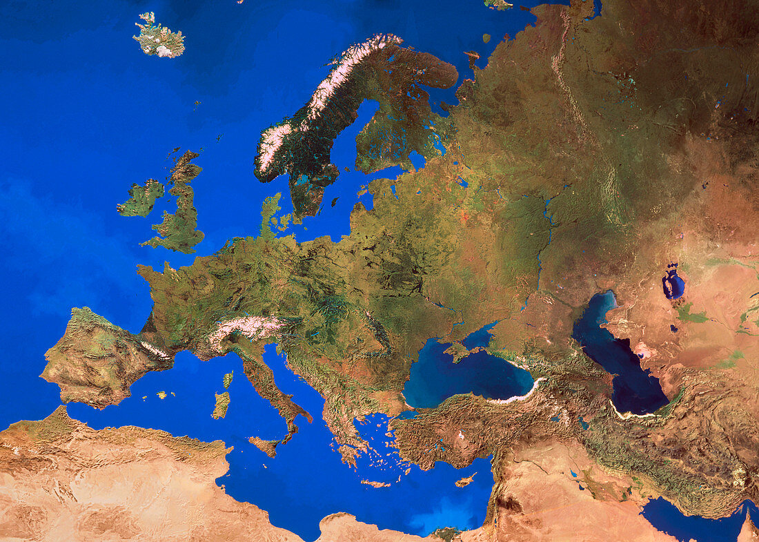
| Europe. Mosaic of satellite images showing Europe and its surroundings. The colours in the image approximate to natural tones,and reflect the climatic changes from the north (dark green,conifer/tundra) through the temperate latitudes (mid-greens) to the arid semi-desert of the Mediterranean and North Africa (browns). The data for this image were gathered by various NOAA weather satellites,with dozens of cloud-free frames used to create the final image | |
| Lizenzart: | Lizenzpflichtig |
| Credit: | Science Photo Library / Worldsat International / Knighton, J. |
| Bildgröße: | 3632 px × 2591 px |
| Modell-Rechte: | nicht erforderlich |
| Eigentums-Rechte: | nicht erforderlich |
| Restrictions: |
|
Preise für dieses Bild ab 15 €
Universitäten & Organisationen
(Informationsmaterial Digital, Informationsmaterial Print, Lehrmaterial Digital etc.)
ab 15 €
Redaktionell
(Bücher, Bücher: Sach- und Fachliteratur, Digitale Medien (redaktionell) etc.)
ab 30 €
Werbung
(Anzeigen, Aussenwerbung, Digitale Medien, Fernsehwerbung, Karten, Werbemittel, Zeitschriften etc.)
ab 55 €
Handelsprodukte
(bedruckte Textilie, Kalender, Postkarte, Grußkarte, Verpackung etc.)
ab 75 €
Pauschalpreise
Rechtepakete für die unbeschränkte Bildnutzung in Print oder Online
ab 495 €