Satellite mosaic of Alaska
Bildnummer 11735675
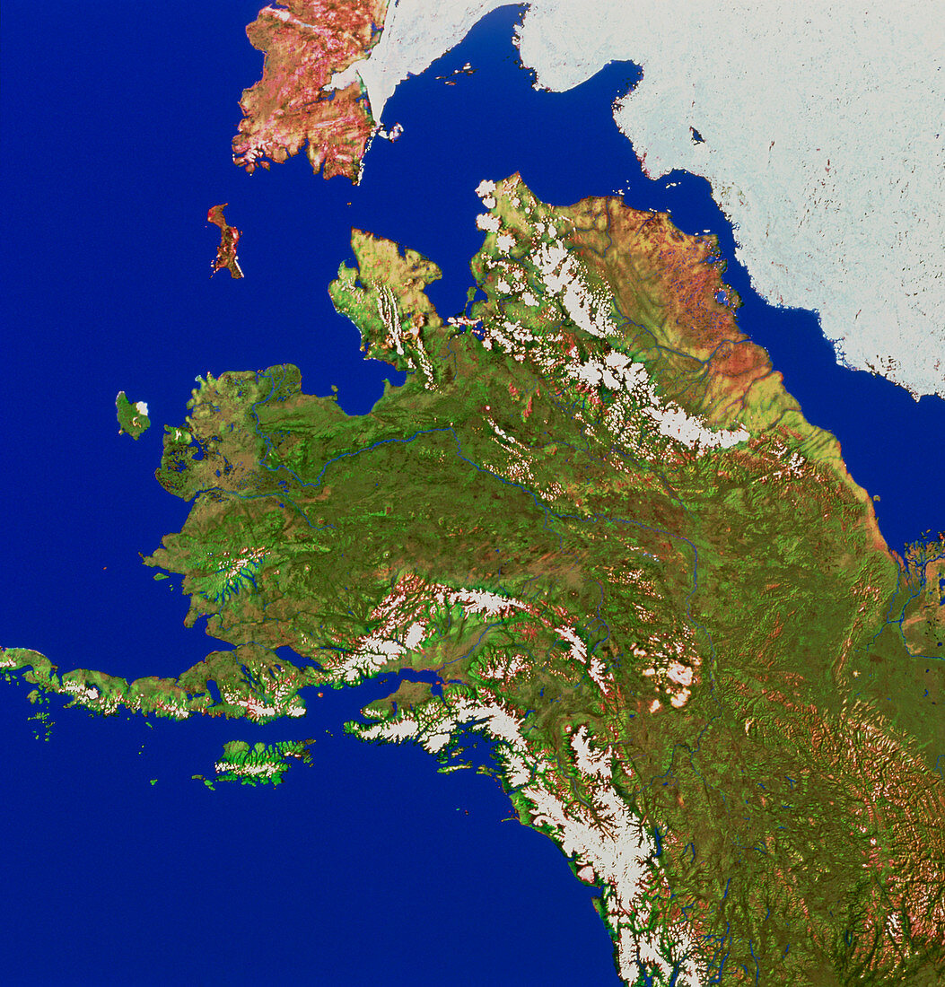
| Alaska. Mosaic of satellite images showing Alaska,the northernmost state of the USA. Most of the land is covered by taiga forests,a high-latitude mixture of conifer species. The brownish land at upper right is tundra,and is the major oil- producing region. The white areas are mountains,including the Aleutian Range (lower left),the Alaskan Range (lower right) and the Brookes Range (upper right). The white patch at top right is the Arctic ice cap. The brownish land at top centre is part of Russia,separated from Alaska by the Bering Strait. The data for this image were gathered by NOAA weather satellites | |
| Lizenzart: | Lizenzpflichtig |
| Credit: | Science Photo Library / Worldsat International |
| Bildgröße: | 4511 px × 4713 px |
| Modell-Rechte: | nicht erforderlich |
| Eigentums-Rechte: | nicht erforderlich |
| Restrictions: |
|
Preise für dieses Bild ab 15 €
Universitäten & Organisationen
(Informationsmaterial Digital, Informationsmaterial Print, Lehrmaterial Digital etc.)
ab 15 €
Redaktionell
(Bücher, Bücher: Sach- und Fachliteratur, Digitale Medien (redaktionell) etc.)
ab 30 €
Werbung
(Anzeigen, Aussenwerbung, Digitale Medien, Fernsehwerbung, Karten, Werbemittel, Zeitschriften etc.)
ab 55 €
Handelsprodukte
(bedruckte Textilie, Kalender, Postkarte, Grußkarte, Verpackung etc.)
ab 75 €
Pauschalpreise
Rechtepakete für die unbeschränkte Bildnutzung in Print oder Online
ab 495 €