Eastern USA
Bildnummer 11735673
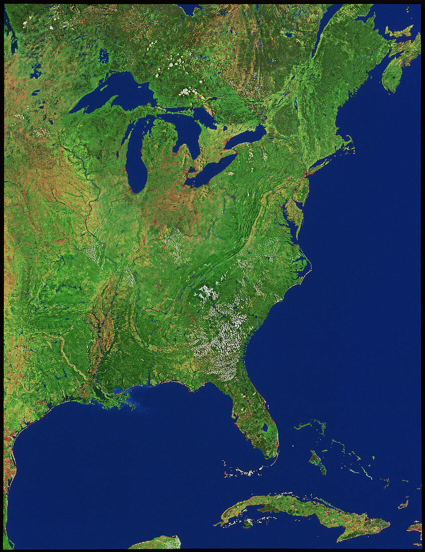
| Eastern USA. Mosaic of satellite images showing the eastern United States. The Atlantic seaboard of the USA runs from Boston and Cape Cod (hook- shaped feature near upper right) down to Florida (below centre). To the left of Florida is the Gulf of Mexico with the prominent Mississippi Delta. Upper left of centre are the Great Lakes,part of the border with Canada. The folds of the Appalachian Mountains may be seen almost parallel to the eastern coast. The island at bottom right is Cuba. The data for this image were gathered by NOAA weather satellites | |
| Lizenzart: | Lizenzpflichtig |
| Credit: | Science Photo Library / Worldsat International |
| Bildgröße: | 3371 px × 4373 px |
| Modell-Rechte: | nicht erforderlich |
| Eigentums-Rechte: | nicht erforderlich |
| Restrictions: |
|
Preise für dieses Bild ab 15 €
Universitäten & Organisationen
(Informationsmaterial Digital, Informationsmaterial Print, Lehrmaterial Digital etc.)
ab 15 €
Redaktionell
(Bücher, Bücher: Sach- und Fachliteratur, Digitale Medien (redaktionell) etc.)
ab 30 €
Werbung
(Anzeigen, Aussenwerbung, Digitale Medien, Fernsehwerbung, Karten, Werbemittel, Zeitschriften etc.)
ab 55 €
Handelsprodukte
(bedruckte Textilie, Kalender, Postkarte, Grußkarte, Verpackung etc.)
ab 75 €
Pauschalpreise
Rechtepakete für die unbeschränkte Bildnutzung in Print oder Online
ab 495 €