Western Europe
Bildnummer 11735667
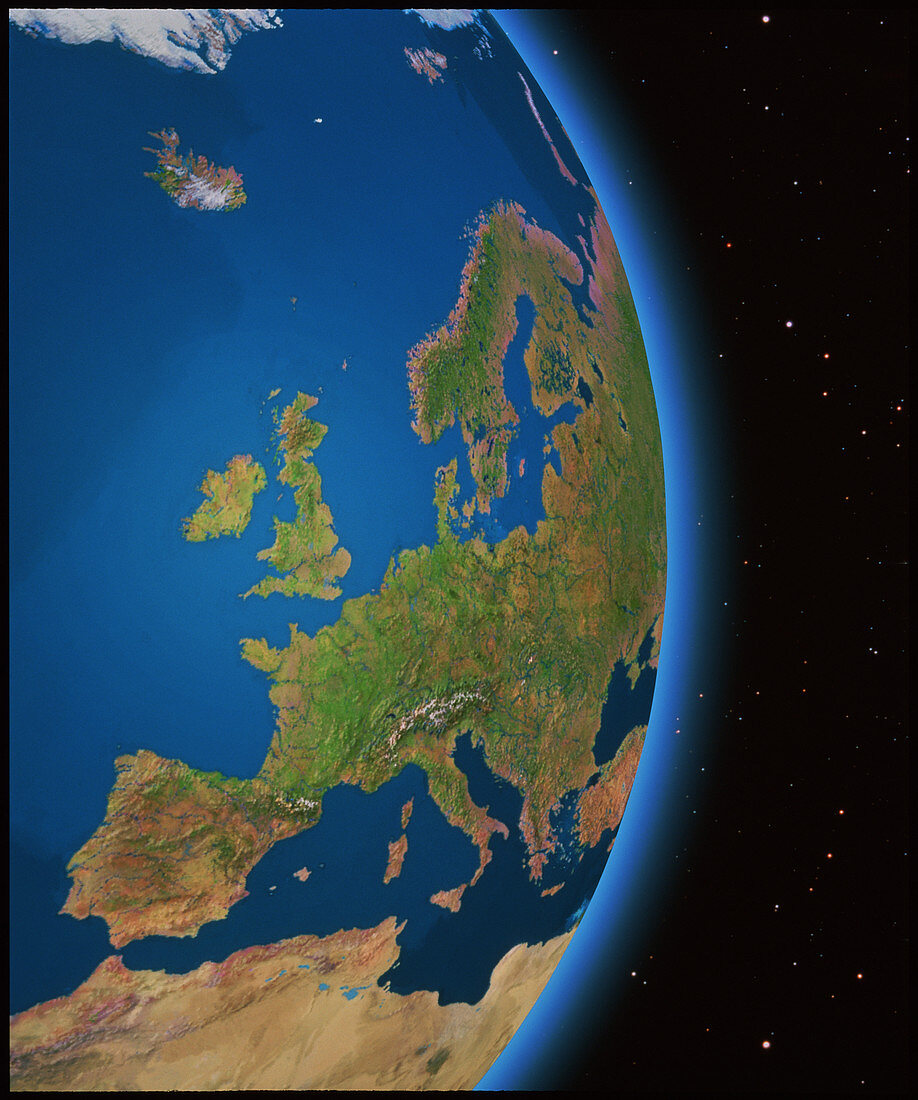
| Western Europe. Satellite mosaic image of Western Europe and the Mediterranean Sea,with an added starfield. The colours in the land represent natural tones. Most of Europe appears green showing lush vegetation. In extreme northern latitudes,the pale purple of the tundra is seen,whilst in southern Europe harsher,semi-arid soils are seen as brown. The deserts of northern Africa and the Middle East are shown in pale brown. River courses have been emphasised for clarity. This image was created from a database of thousands of views of the Earth made by NOAA weather satellites | |
| Lizenzart: | Lizenzpflichtig |
| Credit: | Science Photo Library / GEOSPHERE PROJECT, SANTA MONICA / COPYRIGHT TOM VAN SANT |
| Bildgröße: | 3560 px × 4265 px |
| Modell-Rechte: | nicht erforderlich |
| Eigentums-Rechte: | nicht erforderlich |
| Restrictions: |
|
Preise für dieses Bild ab 15 €
Universitäten & Organisationen
(Informationsmaterial Digital, Informationsmaterial Print, Lehrmaterial Digital etc.)
ab 15 €
Redaktionell
(Bücher, Bücher: Sach- und Fachliteratur, Digitale Medien (redaktionell) etc.)
ab 30 €
Werbung
(Anzeigen, Aussenwerbung, Digitale Medien, Fernsehwerbung, Karten, Werbemittel, Zeitschriften etc.)
ab 55 €
Handelsprodukte
(bedruckte Textilie, Kalender, Postkarte, Grußkarte, Verpackung etc.)
ab 75 €
Pauschalpreise
Rechtepakete für die unbeschränkte Bildnutzung in Print oder Online
ab 495 €
Keywords
- Atmosphäre,
- Belgien,
- Bild,
- Bilder,
- britisch,
- Britische Inseln,
- Deutsche,
- Deutschland,
- Erdkunde,
- Europa,
- Foto,
- Fotos,
- Frankreich,
- Französisch,
- Geographie,
- Geosphärenbilder,
- Großbritannien,
- Irland,
- Island,
- Mittelmeer,
- Niederlande,
- Portugal,
- Satellitenbilder,
- Schottland,
- Schweiz,
- Skandinavien,
- Spanien,
- Vereinigtes Königreich,
- Weltall,
- Westeuropa,
- Wissenschaften