Southern coast of Africa seen from Shuttle STS-58
Bildnummer 11735666
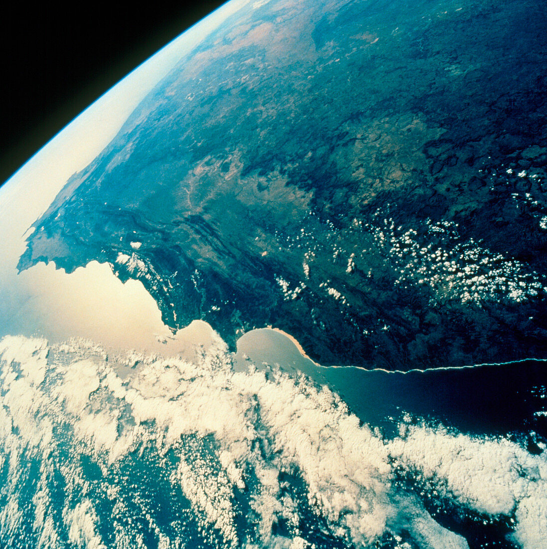
| The southern tip of Africa,seen from space. View looking north west across the southern tip of Africa,as seen by the crew of Shuttle Mission STS-58 of 18 October to 1 November 1993.Just below centre is the rounded,sandy coast of Algoa Bay. At far left is a spit of land,the Cape Peninsula. Just below this is Cape Agulhas,the southernmost point of the African continent. In land at centre is the pale extent of the arid Great Karoo,bounded to the left by a large fold mountain belt and to the right by an escarpment which leads up to the great plateau of South Africa (upper right). The water in the foreground is the Indian Ocean,whilst at upper left is the Atlantic Ocean | |
| Lizenzart: | Lizenzpflichtig |
| Credit: | Science Photo Library / NASA |
| Bildgröße: | 3069 px × 3078 px |
| Modell-Rechte: | nicht erforderlich |
| Eigentums-Rechte: | nicht erforderlich |
| Restrictions: | - |
Preise für dieses Bild ab 15 €
Universitäten & Organisationen
(Informationsmaterial Digital, Informationsmaterial Print, Lehrmaterial Digital etc.)
ab 15 €
Redaktionell
(Bücher, Bücher: Sach- und Fachliteratur, Digitale Medien (redaktionell) etc.)
ab 30 €
Werbung
(Anzeigen, Aussenwerbung, Digitale Medien, Fernsehwerbung, Karten, Werbemittel, Zeitschriften etc.)
ab 55 €
Handelsprodukte
(bedruckte Textilie, Kalender, Postkarte, Grußkarte, Verpackung etc.)
ab 75 €
Pauschalpreise
Rechtepakete für die unbeschränkte Bildnutzung in Print oder Online
ab 495 €