Italy from space
Bildnummer 11735650
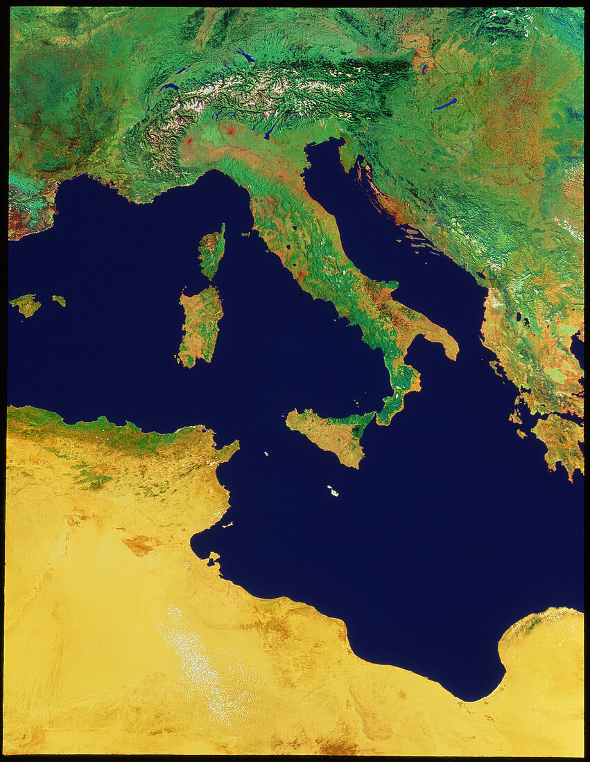
| Central Mediterranean Sea. Mosaic of satellite images showing the central portion of the Mediterranean Sea. At centre is Italy,with the island of Sicily at its base. To the left of Italy are the islands of Corsica (upper) and Sardinia. At the top of Italy are the Alps,seen as white (snow) and dark green (conifer forest). Pale/mid- green denotes mixed grassland and deciduous forest. To the right of Italy is the Adriatic Sea,with the former Yugoslav republic (centre right) and Greece (lower right). At the bottom of the frame is the yellow expanse of the North African deserts. The data for this image were gathered by NOAA weather satellites | |
| Lizenzart: | Lizenzpflichtig |
| Credit: | Science Photo Library / Geospace |
| Bildgröße: | 3361 px × 4343 px |
| Modell-Rechte: | nicht erforderlich |
| Eigentums-Rechte: | nicht erforderlich |
| Restrictions: | - |
Preise für dieses Bild ab 15 €
Universitäten & Organisationen
(Informationsmaterial Digital, Informationsmaterial Print, Lehrmaterial Digital etc.)
ab 15 €
Redaktionell
(Bücher, Bücher: Sach- und Fachliteratur, Digitale Medien (redaktionell) etc.)
ab 30 €
Werbung
(Anzeigen, Aussenwerbung, Digitale Medien, Fernsehwerbung, Karten, Werbemittel, Zeitschriften etc.)
ab 55 €
Handelsprodukte
(bedruckte Textilie, Kalender, Postkarte, Grußkarte, Verpackung etc.)
ab 75 €
Pauschalpreise
Rechtepakete für die unbeschränkte Bildnutzung in Print oder Online
ab 495 €