Scandinavia
Bildnummer 11735649
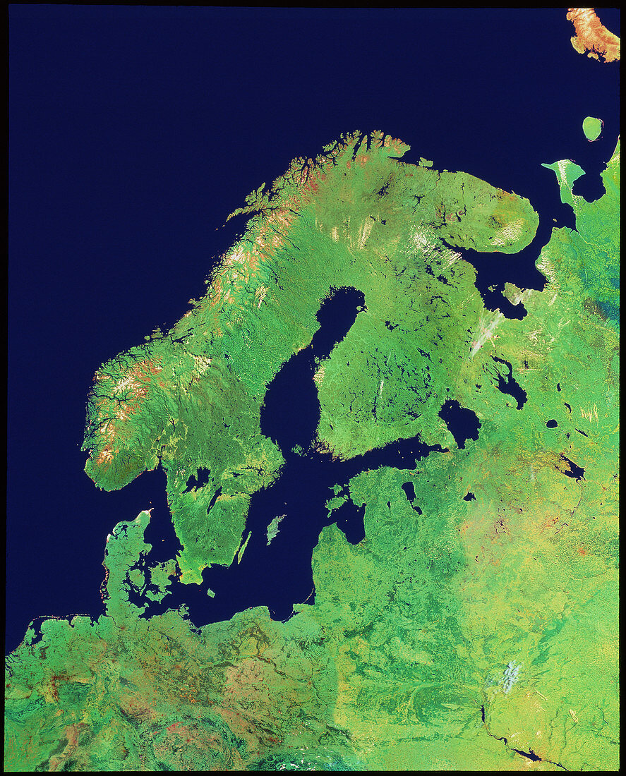
| Scandinavia,from space. Coloured satellite view of Scandinavia and northern Europe. The colours approximate to natural tones. At the centre of the frame is the Baltic Sea. To the east (right) is Finland,to the west is Sweden. The far left edge of Scandinavia is Norway,with many high snow- topped mountains. The west end of the Baltic Sea is almost closed by the peninsula and islands of Denmark. On the south-east coast of the Baltic are the three states of Latvia,Lithuania and Estonia,once part of the former USSR. The right edge of the frame is in Russia. The data for this image were gathered by various NOAA weather satellites | |
| Lizenzart: | Lizenzpflichtig |
| Credit: | Science Photo Library / Geospace |
| Bildgröße: | 3470 px × 4304 px |
| Modell-Rechte: | nicht erforderlich |
| Eigentums-Rechte: | nicht erforderlich |
| Restrictions: | - |
Preise für dieses Bild ab 15 €
Universitäten & Organisationen
(Informationsmaterial Digital, Informationsmaterial Print, Lehrmaterial Digital etc.)
ab 15 €
Redaktionell
(Bücher, Bücher: Sach- und Fachliteratur, Digitale Medien (redaktionell) etc.)
ab 30 €
Werbung
(Anzeigen, Aussenwerbung, Digitale Medien, Fernsehwerbung, Karten, Werbemittel, Zeitschriften etc.)
ab 55 €
Handelsprodukte
(bedruckte Textilie, Kalender, Postkarte, Grußkarte, Verpackung etc.)
ab 75 €
Pauschalpreise
Rechtepakete für die unbeschränkte Bildnutzung in Print oder Online
ab 495 €