Europe NOAA mosaic,summer
Bildnummer 11735641
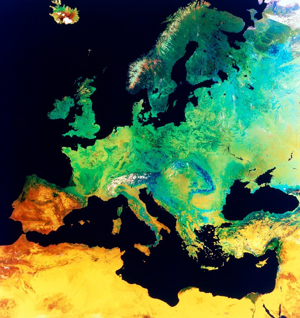
| Enhanced-colour satellite view of Europe. This is a mosaic of several cloud-free images of parts of Europe taken by NOAA weather satellites. The colours indicate different surface cover. In west Europe (left) are rich light and mid-green colours showing pasture and arable land. The bluer greens of the east indicate thinner mountainous and tundra-type vegetation. Scandinavia is dark green,indicating extensive coniferous forests. The Mediterranean coast shows many brown,arid regions whilst northern Africa and the Middle East are covered by yellow desert. This mosaic was made in the summer,so very little snow is seen - a few patches remain in Iceland (top left) and the Alps | |
| Lizenzart: | Lizenzpflichtig |
| Credit: | Science Photo Library / NRSC LTD |
| Bildgröße: | 4069 px × 4318 px |
| Modell-Rechte: | nicht erforderlich |
| Eigentums-Rechte: | nicht erforderlich |
| Restrictions: | - |
Preise für dieses Bild ab 15 €
Universitäten & Organisationen
(Informationsmaterial Digital, Informationsmaterial Print, Lehrmaterial Digital etc.)
ab 15 €
Redaktionell
(Bücher, Bücher: Sach- und Fachliteratur, Digitale Medien (redaktionell) etc.)
ab 30 €
Werbung
(Anzeigen, Aussenwerbung, Digitale Medien, Fernsehwerbung, Karten, Werbemittel, Zeitschriften etc.)
ab 55 €
Handelsprodukte
(bedruckte Textilie, Kalender, Postkarte, Grußkarte, Verpackung etc.)
ab 75 €
Pauschalpreise
Rechtepakete für die unbeschränkte Bildnutzung in Print oder Online
ab 495 €