Europe
Bildnummer 11735639
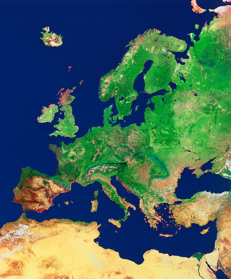
| Satellite mosaic image of the whole of Europe and Scandinavia. The colours approximate to natural tones. Most of Europe is covered with light green showing extensive arable land. Parts of Germany (centre) and most of Scandinavia have a darker green cover of dense coniferous forests. Note the snow cover on the Alps (centre),part of Scotland,Norway (top centre) and Iceland (top left). Warmer countries around the Mediterranean Sea exhibit light brown areas of sparse vegetation: most of northern Africa is covered with pale sandy desert. The image used data from NOAA weather satellites | |
| Lizenzart: | Lizenzpflichtig |
| Credit: | Science Photo Library / Worldsat Productions / NRSC |
| Bildgröße: | 3345 px × 4035 px |
| Modell-Rechte: | nicht erforderlich |
| Eigentums-Rechte: | nicht erforderlich |
| Restrictions: |
|
Preise für dieses Bild ab 15 €
Universitäten & Organisationen
(Informationsmaterial Digital, Informationsmaterial Print, Lehrmaterial Digital etc.)
ab 15 €
Redaktionell
(Bücher, Bücher: Sach- und Fachliteratur, Digitale Medien (redaktionell) etc.)
ab 30 €
Werbung
(Anzeigen, Aussenwerbung, Digitale Medien, Fernsehwerbung, Karten, Werbemittel, Zeitschriften etc.)
ab 55 €
Handelsprodukte
(bedruckte Textilie, Kalender, Postkarte, Grußkarte, Verpackung etc.)
ab 75 €
Pauschalpreise
Rechtepakete für die unbeschränkte Bildnutzung in Print oder Online
ab 495 €