Computer map of global soil types
Bildnummer 11735577
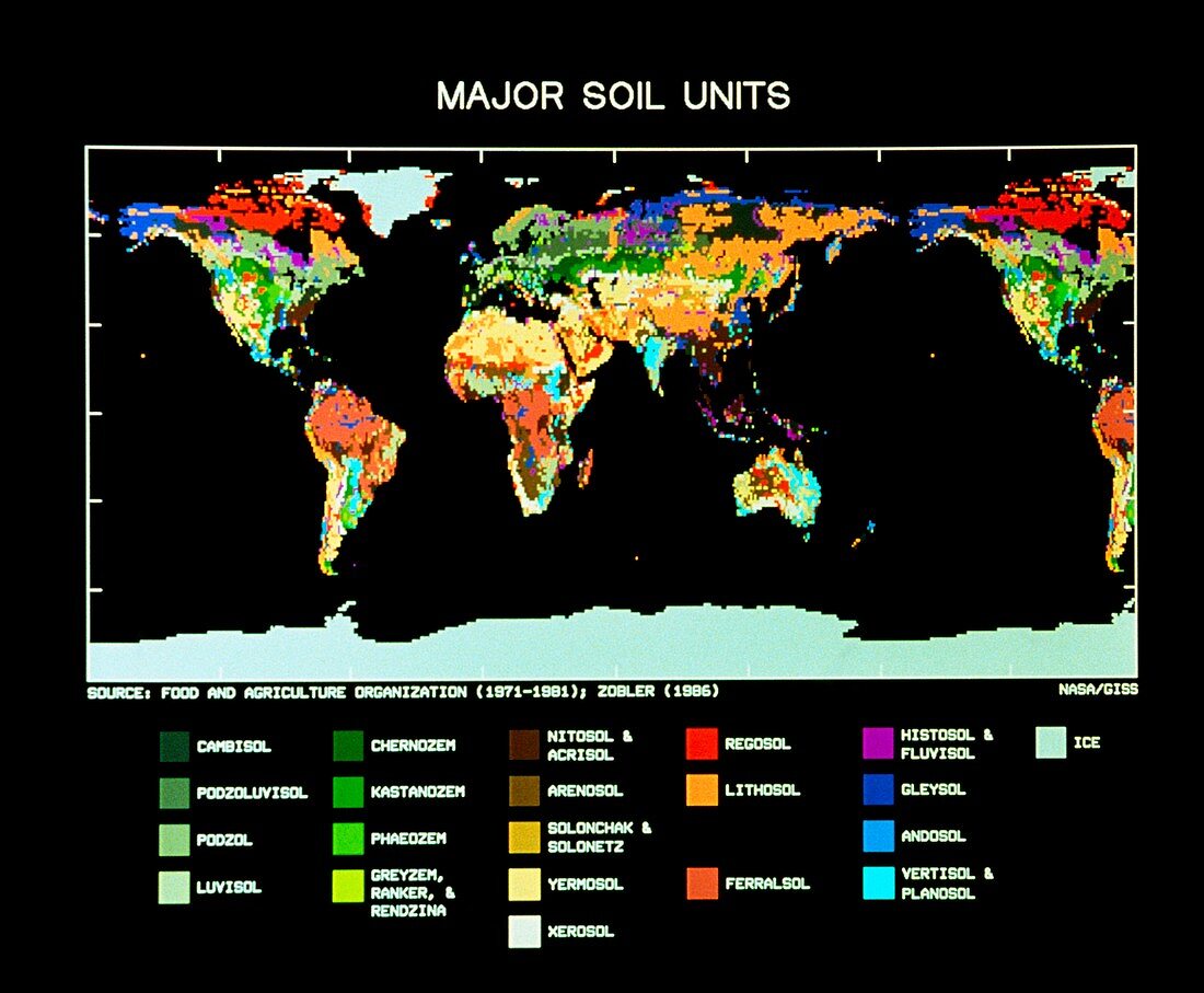
| Computer-generated map of the World showing the distribution of major soil types. The map was produced by digitising maps made by the Food and Agriculture Organisation (FAO). The 106 soil types in the FAO publication were grouped into the 21 major types represented here. The resolution of the map is 1x1 degree of latitude/longitude at the surface | |
| Lizenzart: | Lizenzpflichtig |
| Credit: | Science Photo Library / NASA GODDARD INSTITUTE FOR SPACE STUDIES |
| Bildgröße: | 4655 px × 3839 px |
| Modell-Rechte: | nicht erforderlich |
| Eigentums-Rechte: | nicht erforderlich |
| Restrictions: | - |
Preise für dieses Bild ab 15 €
Universitäten & Organisationen
(Informationsmaterial Digital, Informationsmaterial Print, Lehrmaterial Digital etc.)
ab 15 €
Redaktionell
(Bücher, Bücher: Sach- und Fachliteratur, Digitale Medien (redaktionell) etc.)
ab 30 €
Werbung
(Anzeigen, Aussenwerbung, Digitale Medien, Fernsehwerbung, Karten, Werbemittel, Zeitschriften etc.)
ab 55 €
Handelsprodukte
(bedruckte Textilie, Kalender, Postkarte, Grußkarte, Verpackung etc.)
ab 75 €
Pauschalpreise
Rechtepakete für die unbeschränkte Bildnutzung in Print oder Online
ab 495 €