Detail of 16th century map of Liguria
Bildnummer 11735567
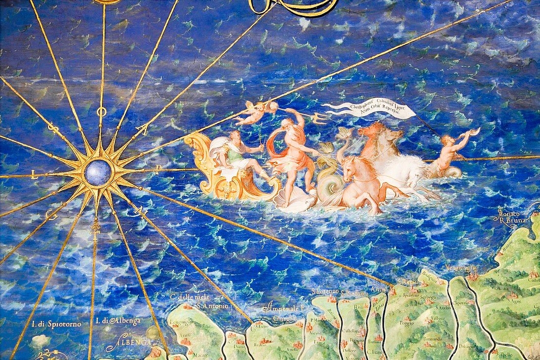
| Detail of 16th century map of Liguria. Detail from the map of Liguria commemorating Christopher Columbus and depicting Neptune,the Roman god of the sea,with his chariot. Liguria is a coastal region of Italy. The map of Liguria is contained in the Gallery of Maps in the Vatican Museum. The Gallery of Maps holds maps which were commissioned between 1578 and 1580 to show the regions of Italy and territories of the church. The maps are based on the work of Ignazio Danti,a 16th century Italian priest,mathematician,astronomer and cosmographer,and are an important record of 16th century geography | |
| Lizenzart: | Lizenzpflichtig |
| Credit: | Science Photo Library / Terry, Sheila |
| Bildgröße: | 4368 px × 2912 px |
| Modell-Rechte: | nicht erforderlich |
| Eigentums-Rechte: | nicht erforderlich |
| Restrictions: | - |
Preise für dieses Bild ab 15 €
Universitäten & Organisationen
(Informationsmaterial Digital, Informationsmaterial Print, Lehrmaterial Digital etc.)
ab 15 €
Redaktionell
(Bücher, Bücher: Sach- und Fachliteratur, Digitale Medien (redaktionell) etc.)
ab 30 €
Werbung
(Anzeigen, Aussenwerbung, Digitale Medien, Fernsehwerbung, Karten, Werbemittel, Zeitschriften etc.)
ab 55 €
Handelsprodukte
(bedruckte Textilie, Kalender, Postkarte, Grußkarte, Verpackung etc.)
ab 75 €
Pauschalpreise
Rechtepakete für die unbeschränkte Bildnutzung in Print oder Online
ab 495 €
Keywords
- 1500er Jahre,
- 16. Jahrhundert,
- Alt,
- Alter,
- Atlas,
- Christopher Columbus,
- Diagramm,
- Erdkunde,
- Erkundung,
- geografisch,
- Geographie,
- Geschichte,
- historisch,
- Ignazio Danti,
- Illustration,
- Italien,
- Italienisch,
- Karte,
- Karten,
- Kartographie,
- Kunstwerk,
- Küste,
- Küsten-,
- Ligurien,
- Marine,
- Maritim,
- Meer,
- Mittelmeer,
- Mythologie,
- Mythologisch,
- Mythos,
- Nautisch,
- Neptun,
- Ozean,
- Sechzehntes Jahrhundert,
- Vatikanische Museen,
- Wissenschaften,
- Zeichnung