Anglo-Saxon 10th century world map
Bildnummer 11735540
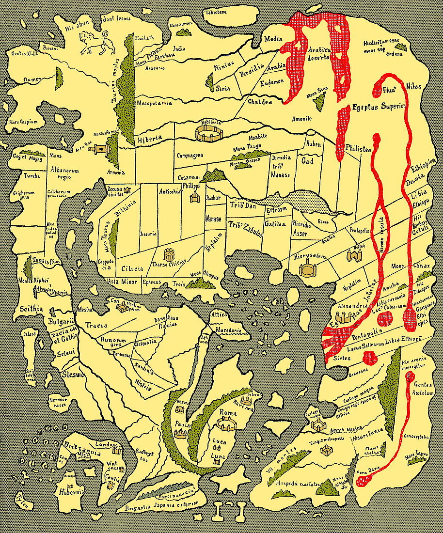
| Anglo-Saxon world map,dating from the 10th century. East is top. This map of the known world was probably produced by an Irish monk. Considering the state of European learning at the time,it is an impressive geographical achievement. However,in terms of accuracy it is outclassed by maps dating from the Classical era. Important landmarks,such as Jerusalem and Rome,are marked. The original is part of the Cotton Library,held in the British Library. Taken from A Book of Discovery (1912) by M.B. Synge | |
| Lizenzart: | Lizenzpflichtig |
| Credit: | Science Photo Library / Terry, Sheila |
| Bildgröße: | 3032 px × 3648 px |
| Modell-Rechte: | nicht erforderlich |
| Eigentums-Rechte: | nicht erforderlich |
| Restrictions: | - |
Preise für dieses Bild ab 15 €
Universitäten & Organisationen
(Informationsmaterial Digital, Informationsmaterial Print, Lehrmaterial Digital etc.)
ab 15 €
Redaktionell
(Bücher, Bücher: Sach- und Fachliteratur, Digitale Medien (redaktionell) etc.)
ab 30 €
Werbung
(Anzeigen, Aussenwerbung, Digitale Medien, Fernsehwerbung, Karten, Werbemittel, Zeitschriften etc.)
ab 55 €
Handelsprodukte
(bedruckte Textilie, Kalender, Postkarte, Grußkarte, Verpackung etc.)
ab 75 €
Pauschalpreise
Rechtepakete für die unbeschränkte Bildnutzung in Print oder Online
ab 495 €