Europe,16th century nautical map
Bildnummer 11735538
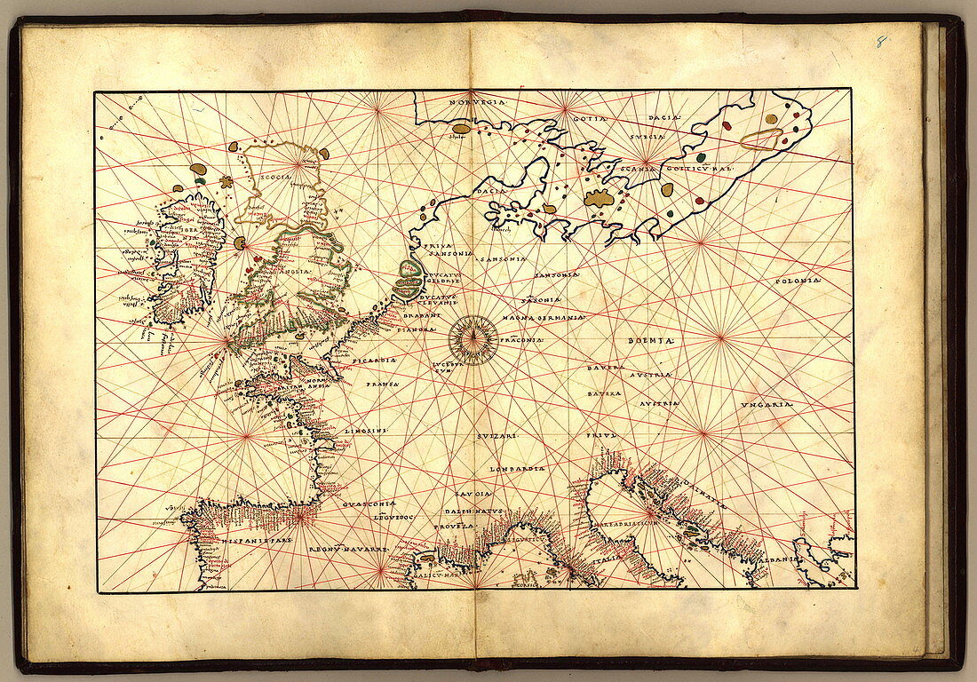
| Nautical map of Europe,1544 copy of Agnese Atlas. Several copies of this atlas were produced between 1536 and 1564,in Venice,by the Italian mapmaker Battista Agnese. The red lines crossing the map (thumb lines) centre on the compass rose at centre of the map,and are used to show distances between points on the map. As a nautical map,only details of the Mediterranean and Western European coasts are shown. The north and Baltic Sea coasts are not labelled. The Baltic coasts and British Isles are not mapped accurately. This edition of the atlas was dedicated to Hieronymus Ruffault,Abbot of St Vaast,Arras,France. It eventually reached the US Library of Congress in 1943 | |
| Lizenzart: | Lizenzpflichtig |
| Credit: | Science Photo Library / LIBRARY OF CONGRESS, GEOGRAPHY AND MAP DIVISION |
| Bildgröße: | 4482 px × 3130 px |
| Modell-Rechte: | nicht erforderlich |
| Eigentums-Rechte: | nicht erforderlich |
| Restrictions: | - |
Preise für dieses Bild ab 15 €
Universitäten & Organisationen
(Informationsmaterial Digital, Informationsmaterial Print, Lehrmaterial Digital etc.)
ab 15 €
Redaktionell
(Bücher, Bücher: Sach- und Fachliteratur, Digitale Medien (redaktionell) etc.)
ab 30 €
Werbung
(Anzeigen, Aussenwerbung, Digitale Medien, Fernsehwerbung, Karten, Werbemittel, Zeitschriften etc.)
ab 55 €
Handelsprodukte
(bedruckte Textilie, Kalender, Postkarte, Grußkarte, Verpackung etc.)
ab 75 €
Pauschalpreise
Rechtepakete für die unbeschränkte Bildnutzung in Print oder Online
ab 495 €