Strabo's map from 18 AD
Bildnummer 11735520
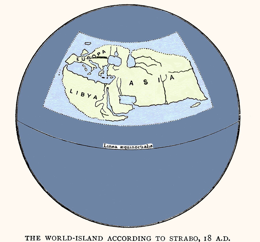
| Strabo's map by Strabo in 18 AD. Reconstruction of the map produced by the Greek philosopher Strabo. One of the first mapmakers to use systematic techniques to provide precision,Strabo drew on knowledge gained from the Roman great census and from conquered lands,and expanded upon the cartographic principles set out in the Hellenistic Age. He used the previous work of Eristophenes (c194 BC) to place the known world in the upper hemisphere of a spherical Earth,and used scientific reasoning to make inferences about unsurveyed areas. The original map has been lost,but Strabo's writing survives | |
| Lizenzart: | Lizenzpflichtig |
| Credit: | Science Photo Library / Terry, Sheila |
| Bildgröße: | 2931 px × 2727 px |
| Modell-Rechte: | nicht erforderlich |
| Eigentums-Rechte: | nicht erforderlich |
| Restrictions: | - |
Preise für dieses Bild ab 15 €
Universitäten & Organisationen
(Informationsmaterial Digital, Informationsmaterial Print, Lehrmaterial Digital etc.)
ab 15 €
Redaktionell
(Bücher, Bücher: Sach- und Fachliteratur, Digitale Medien (redaktionell) etc.)
ab 30 €
Werbung
(Anzeigen, Aussenwerbung, Digitale Medien, Fernsehwerbung, Karten, Werbemittel, Zeitschriften etc.)
ab 55 €
Handelsprodukte
(bedruckte Textilie, Kalender, Postkarte, Grußkarte, Verpackung etc.)
ab 75 €
Pauschalpreise
Rechtepakete für die unbeschränkte Bildnutzung in Print oder Online
ab 495 €