17th century map of South America
Bildnummer 11735502
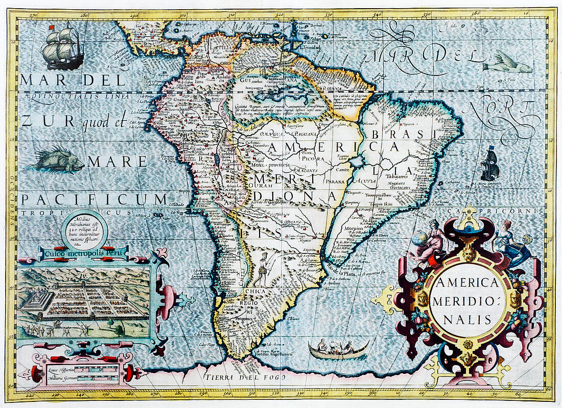
| South America,17th century Dutch map. This shows the new continent that was being discovered by European explorers. The shape is distorted because it had not yet been accurately mapped. Two large rivers in Brazil are shown flowing from a large lake in eastern Brazil. The western coastline is by now fairly accurately mapped,but it was still not realised that Tierra del Fuego (bottom centre) in the Straits of Magellan,was a group of islands and not part of a large southern continent. The inset at lower left shows the Incan city of Cuzco in Peru. This map,published around 1630 by Jodocus Hondius,continued the earlier work of Gerard Mercator | |
| Lizenzart: | Lizenzpflichtig |
| Credit: | Science Photo Library / Douwma, Georgette |
| Bildgröße: | 4902 px × 3564 px |
| Modell-Rechte: | nicht erforderlich |
| Eigentums-Rechte: | nicht erforderlich |
| Restrictions: | - |
Preise für dieses Bild ab 15 €
Universitäten & Organisationen
(Informationsmaterial Digital, Informationsmaterial Print, Lehrmaterial Digital etc.)
ab 15 €
Redaktionell
(Bücher, Bücher: Sach- und Fachliteratur, Digitale Medien (redaktionell) etc.)
ab 30 €
Werbung
(Anzeigen, Aussenwerbung, Digitale Medien, Fernsehwerbung, Karten, Werbemittel, Zeitschriften etc.)
ab 55 €
Handelsprodukte
(bedruckte Textilie, Kalender, Postkarte, Grußkarte, Verpackung etc.)
ab 75 €
Pauschalpreise
Rechtepakete für die unbeschränkte Bildnutzung in Print oder Online
ab 495 €
Keywords
- 17. Jahrhundert,
- Alt,
- Alter,
- Amerikanisch,
- Erdkunde,
- Erforschung,
- Erkundung,
- geografisch,
- Geographie,
- Gerard,
- Gerardus,
- Geschichte,
- historisch,
- hondius,
- Illustration,
- illustriert,
- Karte,
- Karten,
- Kartographie,
- Kunstwerk,
- Latein,
- Mercator,
- Neue Welt,
- Niederländisch,
- Stadt,
- Südamerika,
- Unvollständig,
- verzerrt,
- Wissenschaften