17th century map of Japan
Bildnummer 11735501
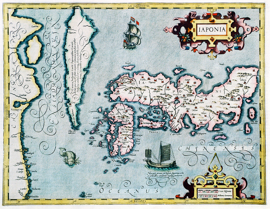
| Japan,17th century Dutch map. These lands had not yet been accurately mapped by Europeans,and the islands of Japan (centre to centre right) are much distorted. Korea (upper left) is still shown as an island,though the text notes that this may not be correct. Illustrations include a European sailing ship (top centre),a Chinese junk (lower centre) and a sea monster (lower left). This map was by Joducus Hondius,based on earlier maps. It was first published in 1606 as a new addition to his atlas that reissued the work of Gerard Mercator | |
| Lizenzart: | Lizenzpflichtig |
| Credit: | Science Photo Library / Douwma, Georgette |
| Bildgröße: | 4749 px × 3679 px |
| Modell-Rechte: | nicht erforderlich |
| Eigentums-Rechte: | nicht erforderlich |
| Restrictions: | - |
Preise für dieses Bild ab 15 €
Universitäten & Organisationen
(Informationsmaterial Digital, Informationsmaterial Print, Lehrmaterial Digital etc.)
ab 15 €
Redaktionell
(Bücher, Bücher: Sach- und Fachliteratur, Digitale Medien (redaktionell) etc.)
ab 30 €
Werbung
(Anzeigen, Aussenwerbung, Digitale Medien, Fernsehwerbung, Karten, Werbemittel, Zeitschriften etc.)
ab 55 €
Handelsprodukte
(bedruckte Textilie, Kalender, Postkarte, Grußkarte, Verpackung etc.)
ab 75 €
Pauschalpreise
Rechtepakete für die unbeschränkte Bildnutzung in Print oder Online
ab 495 €
Keywords
- 17. Jahrhundert,
- Alt,
- Alter,
- Erdkunde,
- Erforschung,
- Erkundung,
- Fernost,
- geografisch,
- Geographie,
- Gerard,
- Gerardus,
- Geschichte,
- historisch,
- hondius,
- Illustration,
- illustriert,
- Japan,
- Japanisch,
- Karte,
- Karten,
- Kartographie,
- Korea,
- Koreanisch,
- Kunstwerk,
- Latein,
- Mercator,
- Niederländisch,
- Unvollständig,
- verzerrt,
- Wissenschaften