16th century map of the British Isles
Bildnummer 11735499
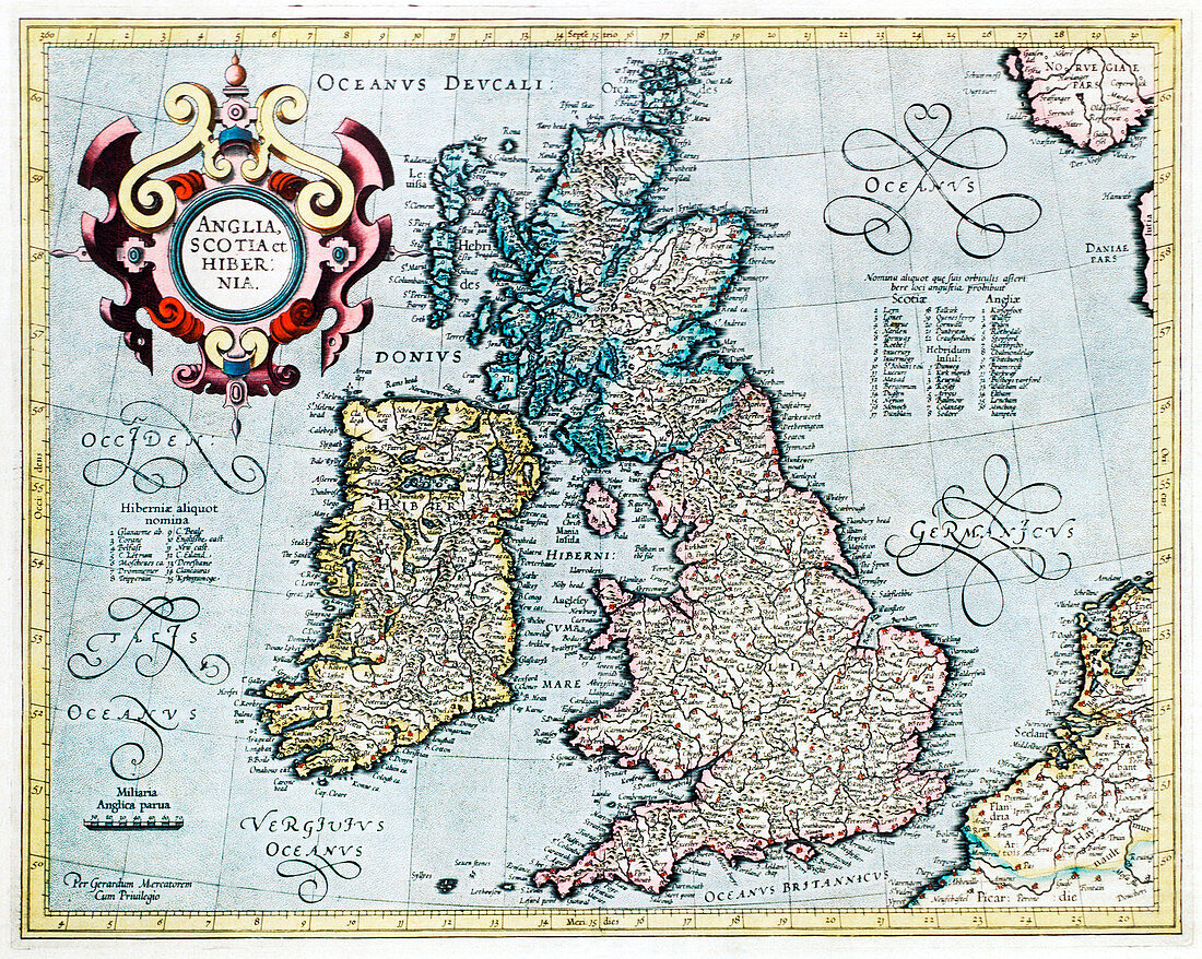
| British Isles,16th century Dutch map. This shows England,Scotland,Wales and Ireland,though Ireland is not yet accurately mapped. Published in 1595,from work by Gerard Mercator | |
| Lizenzart: | Lizenzpflichtig |
| Credit: | Science Photo Library / Douwma, Georgette |
| Bildgröße: | 4680 px × 3736 px |
| Modell-Rechte: | nicht erforderlich |
| Eigentums-Rechte: | nicht erforderlich |
| Restrictions: | - |
Preise für dieses Bild ab 15 €
Universitäten & Organisationen
(Informationsmaterial Digital, Informationsmaterial Print, Lehrmaterial Digital etc.)
ab 15 €
Redaktionell
(Bücher, Bücher: Sach- und Fachliteratur, Digitale Medien (redaktionell) etc.)
ab 30 €
Werbung
(Anzeigen, Aussenwerbung, Digitale Medien, Fernsehwerbung, Karten, Werbemittel, Zeitschriften etc.)
ab 55 €
Handelsprodukte
(bedruckte Textilie, Kalender, Postkarte, Grußkarte, Verpackung etc.)
ab 75 €
Pauschalpreise
Rechtepakete für die unbeschränkte Bildnutzung in Print oder Online
ab 495 €
Keywords
- 16. Jahrhundert,
- Alt,
- Alter,
- britisch,
- Britische Inseln,
- England,
- Englisch,
- Erdkunde,
- geografisch,
- Geographie,
- Gerard,
- Gerardus,
- Geschichte,
- Großbritannien,
- historisch,
- Illustration,
- illustriert,
- Irisch,
- Irland,
- Karte,
- Karten,
- Kartographie,
- Kunstwerk,
- Latein,
- Mercator,
- Niederländisch,
- schottisch,
- Schottland,
- Unvollständig,
- Vereinigtes Königreich,
- verzerrt,
- Wales,
- Walisisch,
- Wissenschaften