Atlas of the world from the 19th century
Bildnummer 11735486
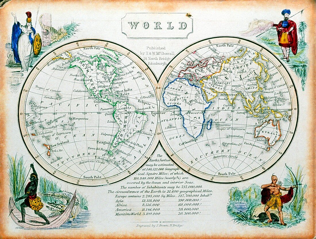
| World atlas. Atlas of the world from the 19th century. The map at left shows the western hemisphere,the eastern hemisphere being shown on the other. Around the map are figures representing some of the peoples of the world. Clockwise from top left they represent: Europe; the Middle East; South-East Asia; Africa. Map drawn in 1850 | |
| Lizenzart: | Lizenzpflichtig |
| Credit: | Science Photo Library / Bernard, George |
| Bildgröße: | 4897 px × 3700 px |
| Modell-Rechte: | nicht erforderlich |
| Eigentums-Rechte: | nicht erforderlich |
| Restrictions: | - |
Preise für dieses Bild ab 15 €
Universitäten & Organisationen
(Informationsmaterial Digital, Informationsmaterial Print, Lehrmaterial Digital etc.)
ab 15 €
Redaktionell
(Bücher, Bücher: Sach- und Fachliteratur, Digitale Medien (redaktionell) etc.)
ab 30 €
Werbung
(Anzeigen, Aussenwerbung, Digitale Medien, Fernsehwerbung, Karten, Werbemittel, Zeitschriften etc.)
ab 55 €
Handelsprodukte
(bedruckte Textilie, Kalender, Postkarte, Grußkarte, Verpackung etc.)
ab 75 €
Pauschalpreise
Rechtepakete für die unbeschränkte Bildnutzung in Print oder Online
ab 495 €