The Americas,from de Wit's Atlas of 1689
Bildnummer 11735478
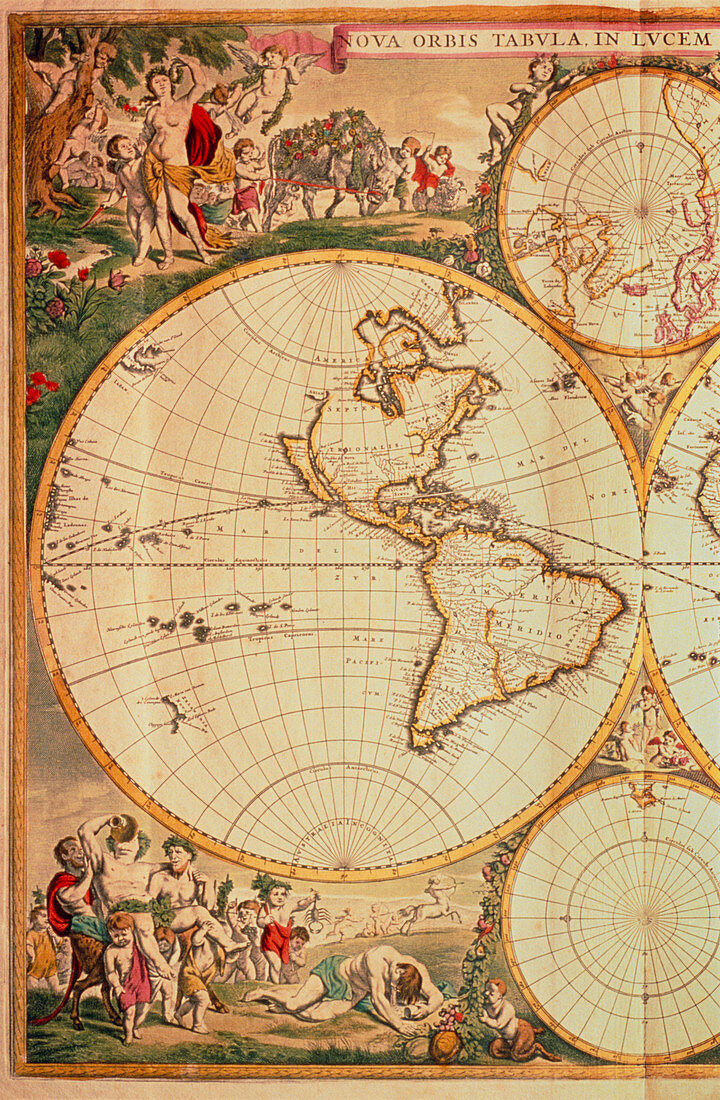
| Historical map of The Americas. This is taken from the World Atlas of Frederick de Wit,dated 1689. Note that explorers had mapped all of South America and much of North America,although Alaska is absent. Note also that California is shown as an island,and that America is depicted as being joined to Greenland | |
| Lizenzart: | Lizenzpflichtig |
| Credit: | Science Photo Library / Bernard, George |
| Bildgröße: | 3306 px × 5048 px |
| Modell-Rechte: | nicht erforderlich |
| Eigentums-Rechte: | nicht erforderlich |
| Restrictions: | - |
Preise für dieses Bild ab 15 €
Universitäten & Organisationen
(Informationsmaterial Digital, Informationsmaterial Print, Lehrmaterial Digital etc.)
ab 15 €
Redaktionell
(Bücher, Bücher: Sach- und Fachliteratur, Digitale Medien (redaktionell) etc.)
ab 30 €
Werbung
(Anzeigen, Aussenwerbung, Digitale Medien, Fernsehwerbung, Karten, Werbemittel, Zeitschriften etc.)
ab 55 €
Handelsprodukte
(bedruckte Textilie, Kalender, Postkarte, Grußkarte, Verpackung etc.)
ab 75 €
Pauschalpreise
Rechtepakete für die unbeschränkte Bildnutzung in Print oder Online
ab 495 €