Earth from space,infrared image,2006
Bildnummer 11735312
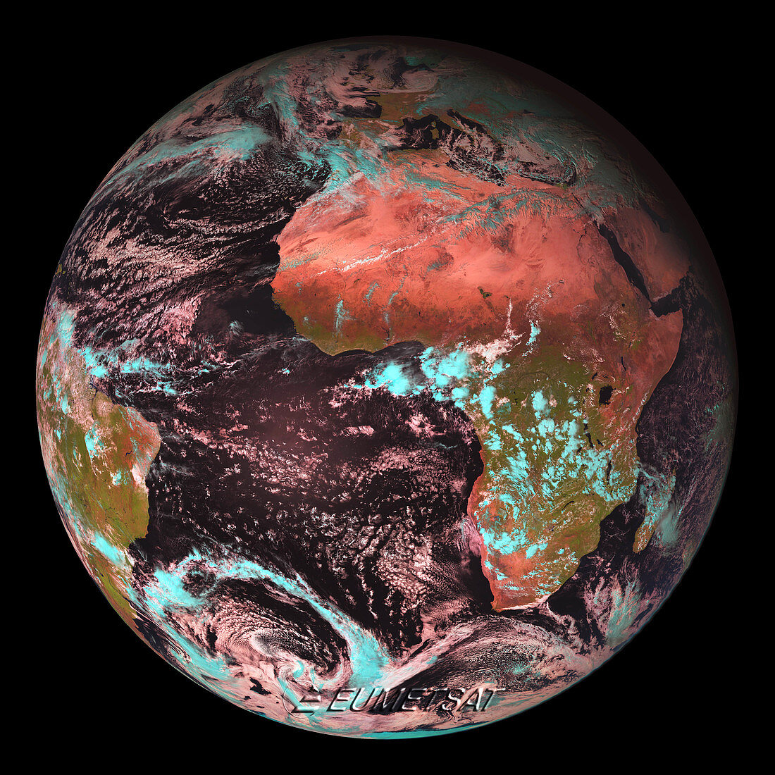
| Earth from space. Combined visible and infrared satellite image of the Earth,centred on the southern Atlantic Ocean. Africa is at upper right,with Europe above it and South American is at lower left. This is the first image produced by the Meteosat Second Generation 2 (MSG-2) weather satellite. The satellite was launched on 21 December 2005 and took this image on 25 January 2006. It will return an image every 15 minutes for use by meteorologists. The image was taken by the spinning enhanced visible and infrared imager (SEVIRI). The four MSG satellites are jointly run by the European Space Agency (ESA) and the European organisation for the exploitation of meteorological satellites (EUMETSAT) | |
| Lizenzart: | Lizenzpflichtig |
| Credit: | Science Photo Library / EUMETSAT / EUROPEAN SPACE AGENCY |
| Bildgröße: | 3969 px × 3969 px |
| Modell-Rechte: | nicht erforderlich |
| Eigentums-Rechte: | nicht erforderlich |
| Restrictions: |
|
Preise für dieses Bild ab 15 €
Universitäten & Organisationen
(Informationsmaterial Digital, Informationsmaterial Print, Lehrmaterial Digital etc.)
ab 15 €
Redaktionell
(Bücher, Bücher: Sach- und Fachliteratur, Digitale Medien (redaktionell) etc.)
ab 30 €
Werbung
(Anzeigen, Aussenwerbung, Digitale Medien, Fernsehwerbung, Karten, Werbemittel, Zeitschriften etc.)
ab 55 €
Handelsprodukte
(bedruckte Textilie, Kalender, Postkarte, Grußkarte, Verpackung etc.)
ab 75 €
Pauschalpreise
Rechtepakete für die unbeschränkte Bildnutzung in Print oder Online
ab 495 €
Keywords
- 21. Jahrhundert,
- Afrika,
- Atlantischer Ozean,
- einer,
- Erdbeobachtung,
- Erde,
- Erdkunde,
- erst,
- esa,
- EUMETSAT,
- Europäische Weltraumbehörde,
- Globus,
- infrarot,
- ir,
- Kontinent,
- Meer,
- Meteorologie,
- meteorologisch,
- msg-2,
- Organisation,
- Ozean,
- Planet,
- Raum,
- rund,
- Satellitenbild,
- sichtbares Licht,
- Single,
- Sonnensystem,
- Südamerika,
- Technologie,
- technologisch,
- Wasser,
- Welt,
- Weltall,
- Wetter,
- Wissenschaften,
- Wolke,
- Wolken,
- Wüste