Whole Earth map
Bildnummer 11735245
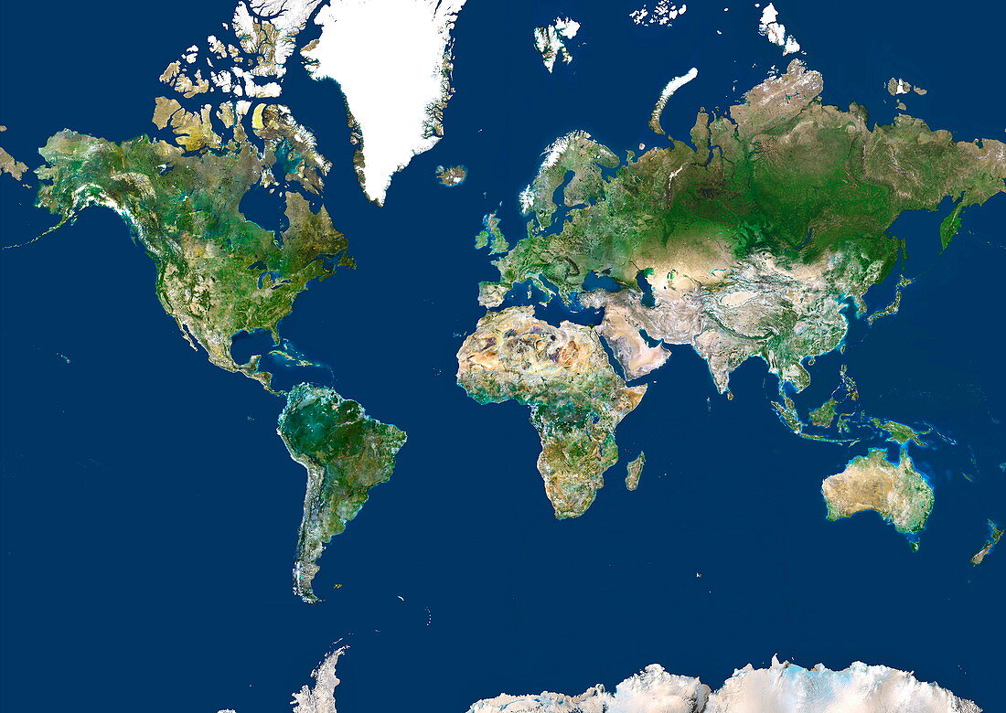
| Whole Earth map based on satellite data. The land terrain is mostly vegetation (green) or arid land (brown). The polar regions are covered by snow and ice (white),though sea ice is not shown. The major geographical features include the deserts of North Africa (centre),the mountain ranges in central Asia (centre right),the Amazon rainforest in South America (lower left),and the Greenland ice cap (upper left). This cylindrical projection (specifically a Mercator projection) distorts the area of polar regions. Greenland should be about eight times smaller than South America | |
| Lizenzart: | Lizenzpflichtig |
| Credit: | Science Photo Library / Planetobserver |
| Bildgröße: | 4949 px × 3508 px |
| Modell-Rechte: | nicht erforderlich |
| Eigentums-Rechte: | nicht erforderlich |
| Restrictions: | - |
Preise für dieses Bild ab 15 €
Universitäten & Organisationen
(Informationsmaterial Digital, Informationsmaterial Print, Lehrmaterial Digital etc.)
ab 15 €
Redaktionell
(Bücher, Bücher: Sach- und Fachliteratur, Digitale Medien (redaktionell) etc.)
ab 30 €
Werbung
(Anzeigen, Aussenwerbung, Digitale Medien, Fernsehwerbung, Karten, Werbemittel, Zeitschriften etc.)
ab 55 €
Handelsprodukte
(bedruckte Textilie, Kalender, Postkarte, Grußkarte, Verpackung etc.)
ab 75 €
Pauschalpreise
Rechtepakete für die unbeschränkte Bildnutzung in Print oder Online
ab 495 €
Keywords
- Afrika,
- Afrikanisch,
- Amerikanisch,
- Antarktis,
- Asiatisch,
- Asien,
- Erdbeobachtung,
- Erde,
- Eurasien,
- Europa,
- geografisch,
- Geographie,
- Karte,
- Kartographie,
- Kontinent,
- Kontinente,
- Mercator,
- Nordamerika,
- Ozeanien,
- Planet,
- Projektion,
- Satellit,
- Satellitenbild,
- Südamerika,
- Technologie,
- verzerrt,
- Welt,
- Weltall,
- weltweit