Whole Earth map
Bildnummer 11735238
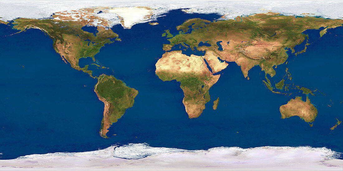
| Whole Earth map based on satellite data. The land is dominated by vegetation (green) or arid land (brown),such as the deserts of North Africa. The polar regions are covered by snow and ice (white) on sea and on land. The map is based on year-long observations by American NOAA weather satellites for cloud-free coverage. Ocean coastal colour (due to chlorophyll content) is provided by the Nimbus 7 weather satellite. The polar regions were imaged with the DMSP weather satellites which are in polar orbits. This map is a latitude-longitude cylindrical projection that distorts and magnifies polar regions relative to equatorial regions | |
| Lizenzart: | Lizenzpflichtig |
| Credit: | Science Photo Library / Planetary Visions |
| Bildgröße: | 3500 px × 1750 px |
| Modell-Rechte: | nicht erforderlich |
| Eigentums-Rechte: | nicht erforderlich |
| Restrictions: | - |
Preise für dieses Bild ab 15 €
Universitäten & Organisationen
(Informationsmaterial Digital, Informationsmaterial Print, Lehrmaterial Digital etc.)
ab 15 €
Redaktionell
(Bücher, Bücher: Sach- und Fachliteratur, Digitale Medien (redaktionell) etc.)
ab 30 €
Werbung
(Anzeigen, Aussenwerbung, Digitale Medien, Fernsehwerbung, Karten, Werbemittel, Zeitschriften etc.)
ab 55 €
Handelsprodukte
(bedruckte Textilie, Kalender, Postkarte, Grußkarte, Verpackung etc.)
ab 75 €
Pauschalpreise
Rechtepakete für die unbeschränkte Bildnutzung in Print oder Online
ab 495 €
Keywords
- 1,
- Bild,
- Bilder,
- DMSP,
- Eis,
- Erde,
- Erdkunde,
- Foto,
- Fotos,
- Ganze,
- geografisch,
- Geographie,
- Karte,
- Kartographie,
- Kontinent,
- Kontinente,
- Land,
- Meer,
- Mosaik-,
- NOAA,
- Ozean,
- Pflanzen,
- Planet,
- planetarisch,
- Projektion,
- projiziert,
- Satellit,
- Schnee,
- topografisch,
- Topographie,
- Vegetation,
- Wald,
- Wasser,
- Welt,
- weltweit,
- Wissenschaften,
- Wüste,
- Zusammengesetzt