Earth
Bildnummer 11735217
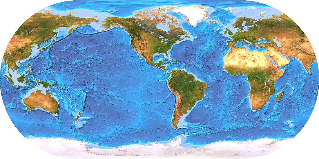
| Earth. Coloured computer model of the Earth centred on Central America,based on satellite data. North is at top. Water is blue,bare land is brown,vegetation is green and snow and ice are white. To the left of North and South America (down centre) is the Pacific Ocean. This is bordered by mainland Asia (top left) and Australasia (lower left). To the right of the Americas lies the Atlantic Ocean,which extends north to the Arctic (across top) and east to Africa (centre right). Also seen are Europe (top right) and Antarctica (white,bottom). Ocean floor topography is shown in varying shades of blue | |
| Lizenzart: | Lizenzpflichtig |
| Credit: | Science Photo Library / Planetary Visions |
| Bildgröße: | 3500 px × 1749 px |
| Modell-Rechte: | nicht erforderlich |
| Eigentums-Rechte: | nicht erforderlich |
| Restrictions: | - |
Preise für dieses Bild ab 15 €
Universitäten & Organisationen
(Informationsmaterial Digital, Informationsmaterial Print, Lehrmaterial Digital etc.)
ab 15 €
Redaktionell
(Bücher, Bücher: Sach- und Fachliteratur, Digitale Medien (redaktionell) etc.)
ab 30 €
Werbung
(Anzeigen, Aussenwerbung, Digitale Medien, Fernsehwerbung, Karten, Werbemittel, Zeitschriften etc.)
ab 55 €
Handelsprodukte
(bedruckte Textilie, Kalender, Postkarte, Grußkarte, Verpackung etc.)
ab 75 €
Pauschalpreise
Rechtepakete für die unbeschränkte Bildnutzung in Print oder Online
ab 495 €
Keywords
- 1,
- Afrika,
- Amerika,
- Antarktis,
- Arktis,
- Asien,
- Atlantisch,
- Bathymetrie,
- Bild,
- Bilder,
- Bildgebung,
- Computermodell,
- Daten,
- Eis,
- Erde,
- Erdkunde,
- Eurasien,
- Europa,
- farbig,
- geografisch,
- Geographie,
- Indisch,
- Karte,
- Kartographie,
- Kontinent,
- Land,
- Meer,
- Modelling,
- Norden,
- Ozean,
- Ozeane,
- Pazifik,
- polar,
- Pole,
- Projektion,
- Satellitenbild,
- Schnee,
- Süden,
- topografisch,
- Topographie,
- topographisch,
- Vegetation,
- Wasser,
- Wissenschaften,
- zentral